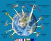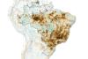
Regional Focus of our members and resources

Disclaimer: The designations employed and the presentation of material on this map do not imply the expression of any opinion whatsoever on the part of the Secretariat of the United Nations concerning the legal status of any country, territory, city or area or of its authorities, or concerning the delimitation of its frontiers or boundaries. They solely serve navigation purposes on this page. Please also note that the map does not filter items if the search term filter is used.

Article

Interview with Pankaj Kumar, Associate Professor, G.B. Pant University of Agriculture and Technology
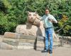
Dr. Pankaj Kumar’s personal experience with water scarcity in the Kumaon Himalayas shaped his lifelong commitment to understanding and protecting water resources. This early connection now underpins his work as an Associate Professor at G.B. Pant University of Agriculture and Technology, where he teaches and conducts research in hydrological modeling, watershed management, and geoinformatics, while also engaging directly with farming communities through extension activities. Throughout the interview, he emphasizes how space technologies have transformed watershed science – shifting from labor-intensive surveys to rapid, comprehensive satellite-based observations that reveal land cover, soil moisture, vegetation health, and hydrological processes in near real time. His contribution to the UNEP-TEEB Agri-Food project in Uttarakhand, where he worked on ecosystem services and sustainable agriculture, stands out as a particularly meaningful part of his career. Dr. Kumar highlights India’s complex water challenges, shaped by monsoon dependency, groundwater decline, and pollution, and explains how Indian satellite missions and geoportals are increasingly supporting integrated water management. He also stresses the urgency of monitoring the Himalayas, where accelerated glacier melt threatens long-term water security for the region. Integrating machine learning with geospatial data, he works to improve forecasting, assess ecosystem services, and guide more resilient water-planning decisions. He concludes by reflecting on his favourite form of water – snow – which he sees as both a symbol of natural beauty and a reminder of the importance of protecting the glaciers that sustain life in the Himalayas.

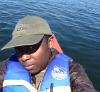
Interview with Mengyi Jin, recent PhD graduate at Shanghai Jiao Tong University

The interview explores Dr. Mengyi Jin’s personal and academic connection to water and space technologies, starting from how she relates to water both personally and professionally. During her PhD in Civil Engineering, she focused on how urban form and green infrastructure influence environmental quality, looking at fine-scale variations of air pollution, temperature, and humidity within cities. Her research used mobile monitoring combined with spatial analysis and satellite data to understand how environmental conditions change from place to place. Dr. Jin highlights the links between air quality and the water cycle, noting that aerosols affect cloud formation, rainfall, and evapotranspiration, and that air pollution can enter water bodies and lead to water contamination. She also explains how nature-based solutions, such as urban green spaces and wetlands, can address climate and environmental challenges in a sustainable way, and how satellites support these solutions by monitoring vegetation, land cover, water bodies, and atmospheric pollutants. Her experience in the EU project GoGreenRoutes illustrates how green infrastructure contributes to sustainable development by improving environmental and social conditions in cities. Although the project focuses mainly on green elements, blue spaces like green riverbanks or wetlands can also play a complementary role. She notes that space technologies are not the main monitoring method in the project, but can serve as a valuable supplement. Looking ahead, Dr. Jin sees space-based technologies, combined with in situ measurements, as essential for understanding environmental change at multiple scales. She also emphasizes cross-disciplinary thinking, open data, and collaboration as key drivers of innovation in environmental research.

Interview with Dr. Christopher Ilori

Dr. Christopher Olayinka Ilori is an Earth Observation Specialist with over 10 years of experience transforming satellite data into actionable insights for environmental sustainability, marine conservation, and coastal resilience. He works as an independent remote sensing contractor, leading projects on Satellite-Derived Bathymetry (SDB) that apply radiative transfer modelling and machine learning to map shallow-water environments critical to navigation safety, coastal management, and ecosystem protection. His current research focuses on physics-informed machine learning (PIML) - embedding governing physical laws directly into deep learning architectures to deliver predictions that are accurate, transferable, and uncertainty-aware. He is extending this approach beyond bathymetry to other domains where quantified uncertainty drives consequential decisions, including water resources, agriculture, energy, and health.

Transforming polar science: space technologies in assessing Antarctica’s cryosphere

Antarctica, Earth’s southernmost continent, contains the largest reservoir of freshwater on the planet, holding approximately 68.7 per cent of global freshwater in the form of ice sheets and glaciers (NSIDC 2025; Rignot et al. 2019). Together with Greenland, these ice sheets store over 99 per cent of the world’s freshwater ice, with the Antarctic Ice Sheet alone covering nearly 14 million square kilometres and containing about 30 million cubic kilometres of ice (NSIDC 2025). This massive ice reserve plays a crucial role in global sea levels and climate systems (IPCC 2021).

Interview with Dr. Kamal Labbassi

The following interview with Dr. Kamal Labbassi, President of the African Association of Remote Sensing of the Environment (AARSE), focuses on the role of space technologies and Earth observation in water resource management, capacity building, and sustainable development in Africa. Water is a strategic and vital resource for the continent, particularly in regions affected by scarcity, climate change, floods, and droughts. Drawing on his long-standing experience in remote sensing, research, and policy advisory roles, Dr. Labassi explains how space technologies provide critical information on water availability, quality, and spatial distribution, supporting integrated and evidence-based water management. The interview highlights his early engagement with the ESA-led TIGER initiative, which pioneered the use of Earth observation for water management in Africa through networking, training, and free data access, and discusses lessons learned from continental programs such as GMES and Africa. The importance of capacity building and user-driven approaches is emphasized, particularly the need to identify stakeholder needs across the full water management chain and to foster inclusive, non-fiscal incentives for knowledge sharing and community building. The work and achievements of AARSE are outlined, including its role in awareness raising, training, international cooperation, and policy support across Africa. The interview further explores regional experiences, especially from the Sahel, where satellite-based monitoring and early warning systems for droughts and floods offer valuable lessons despite ongoing challenges related to infrastructure, data access, political stability, and human capacity. Dr. Labassi also reflects on Africa’s space policy and strategy, underscoring the importance of Earth observation and geospatial information for environmental monitoring and natural resource management across a vast and diverse continent, as well as the coordinating role of the African Space Agency. International cooperation initiatives, such as the Digital Belt and Road program, are discussed with a focus on water-related research using big Earth data. The interview concludes by highlighting recent advances in space technologies for water, remaining gaps in the global debate – particularly around equitable data access, capacity building, and interdisciplinary collaboration – and the central role of science and cooperation in achieving the Sustainable Development Goals related to water, climate action, and ecosystem preservation.

A global eye on water: What the SWOT mission reveals about Earth’s water

From Nile floods to satellites: Humanity’s long quest to measure water

For as long as people have lived near rivers and seas, we have watched the water, measured it and tried to understand it because our survival depended on it. In fact, ancient Egyptians built nilometers along the Nile more than 5,000 years ago to predict floods while in China early engineers estimated the speed of rivers with floating objects. In Europe thinkers like Leonardo da Vinci designed new ways to track river flow.

Interview with Deanesh Ramsewak, Assistant Professor at University of Trinidad and Tobago

This interview introduces Deanesh Ramsewak, Assistant Professor in Practice at the University of Trinidad and Tobago, who is using geospatial and remote sensing tools to protect mangroves and coastal wetlands across Trinidad and Tobago and the wider Caribbean. He combines satellite data, drones, aerial imagery, field surveys, and machine learning to create practical and cost effective monitoring methods that help agencies and practitioners tackle habitat loss, sea level rise, erosion, flooding, and other climate impacts. He also contributes to the UN Ocean Decade Digital Twins of the Ocean initiative, promoting open data, transparent workflows, and stronger collaboration to build coastal resilience.

CryoWatch: Leveraging open Earth observation data for transboundary snow hydrology monitoring in the European Alps and Danube Basin

Spring melt-out from mountain regions sustain lives, economies and ecosystems downstream. Each spring, massive volumes of meltwater cascade from Alpine regions into the Danube. Although Alpine catchments make up only 10 per cent of the Danube basin, approximately 26 per cent of its total discharge comes from them ​(Wesemann, Herrnegger, and Schulz 2018)​. This water feeds reservoirs, irrigate croplands and sustain over 80 million people across 19 countries ​(ICPDR 2021)​.

The role of space technologies in integrated water resources management      

On a sweltering summer day along the banks of the Mekong River, villagers in Laos watched nervously as water levels fell dramatically. Upstream, hydropower dams in China had altered the river’s flow, leaving communities downstream scrambling for water to irrigate crops, sustain fisheries, and meet drinking needs. This scene is far from unique. Across the world, transboundary rivers are flashpoints of tension, where one country’s energy or agricultural ambitions can ripple downstream, affecting millions of people (UNESCO 2023). Global water stress is escalating at an unprecedented pace.

Interview with Dawit Kanito, PhD Candidate in Geology (specializing in Hydrogeology) at King Fahd University of Petroleum and Minerals (KFUPM)

This interview presents Mr. Kanito’s journey and passion for advancing sustainable water management under the twin pressures of climate change and human activity. He emphasizes the power of integrating observation data, space technologies, and machine learning for groundwater modelling. His vision is to equip communities with the knowledge and tools to manage water resources sustainably, ensuring a healthier, more resilient future for all.

Space4Water Consultant for Community, Content and Communications

Result of service

Under the supervision of the Chief, Space Applications Section / Interims Space4Water Project Lead, Space Applications Section , the contributions of the consultant include the below listed tasks:
  • Plans for content releases were developed scheduling upcoming article and interview publications for the Space4Water Portal;
  • Relevant conferences and events have been researched and a plan for the missions to be undertaken during 2026 submitted to the supervisor;
  • Monthly articl

Interview with Marina Agarkova, Master Student of Cartography and Geoinformation at the University of Vienna

Marina Agarkova shares her experience as a Space4Water intern at UNOOSA, and details related to her university studies in Cartography and Geoinformation, including her master’s thesis. She discusses how geographic information systems (GIS) are used for addressing challenges such as climate change and water-related issues. Marina highlights the water-related challenge of land cover change detection in hydrographic basins in Venezuela, that she is collaborating on. She considers what difficulties the general public may encounter in understanding the topics of space technology and water management. Marina also discusses GIS software and mapping in terms of the target audience.

The role of Global Navigation Satellite Systems (GNSS) in water monitoring

Imagine a small coastal community at the periphery of a tropical storm. Hours before the first waves hit, an antenna smaller than a dinner plate begins detecting subtle changes in signal patterns from satellites thousands of kilometres overhead. Within minutes those changes reveal that the tide is rising far faster than normal. A sign of a storm surge. Warnings are issued and lives are saved.

Interview with Shagun Garg, Doctoral Researcher, University of Cambridge

In this interview, Shagun Garg, a Doctoral Researcher at the University of Cambridge, shares his journey working at the intersection of water and space technologies. From early experiences with groundwater-related land subsidence in Delhi to improving flood detection methods, his work highlights the advantages and limitations of satellite data in tackling real-world water challenges. Shagun discusses how nature-based solutions, remote sensing, and machine learning come together in his current research to support more sustainable water management. He also reflects on the importance of inclusive approaches that don’t leave out regions or people due to technical constraints. Throughout, he emphasises curiosity, collaboration, and the value of noticing what others might overlook.

Rivers in the sky: atmospheric rivers, climate change and the role of space technologies

Atmospheric Rivers (ARs) are long, narrow corridors of moisture. They are an atmospheric phenomenon that transport massive amounts of water vapor across the globe. While they replenish water supplies and sustain ecosystems, ARs also pose significant flood risks, especially as climate change intensifies their impact. Recent studies indicate ARs are becoming more powerful, with increasing moisture transport and precipitation. Space technologies such as radio occultation (GNSS RO), passive microwave imager (e.g. SSMI/S), optical imagers (e.g. MODIS) and geostationary sensors (e.g. GOES) detect Ars, track their evolution and feed global forecast models. This article additionally outlines operational efforts such as Atmospheric River Reconnaissance and Forecast-Informed Reservoir Operations, where satellite-supported forecasts have been used to adjust reservoir releases and improve water storage without increasing flood risk. With a warming climate expected to increase the moisture carried by ARs, communities from coastal cities to mountain catchments have strong reasons to car. Better satellite data turns an invisible driver of both drought relief and flooding into actionable information for smarter water management.

Interview with Mayar Fahim, Aerospace Engineer at Egyptian Space Agency

My name is Mayar Fahim, and I am an Aerospace Engineer at the Egyptian Space Agency, specializing in the Attitude and Orbit Control Subsystem (AOCS) hardware. My role bridges innovation, applied research, and the strategic application of space technologies for national development. I hold a bachelor's degree in Aircraft and Rocket Construction and Design from the National Aerospace University in Ukraine and am currently pursuing a master's degree in Aerospace Engineering at the Military Technical College in Cairo. I actively participate in global youth science diplomacy initiatives, including the BRICS+ Youth Club and the World Youth Festival in Sochi, Russia. I believe that space technologies should address real-world challenges, especially in climate-vulnerable regions. My work contributes to Egypt’s satellite missions focused on water monitoring, agriculture, and sustainable resource management. I advocate for localizing user needs in satellite applications and fostering cross-sector collaboration to ensure that satellite data translates into actionable insights. A recent focus of my work includes using satellite imagery to support decision-making in water resource distribution and sustainable agriculture in desert reclamation zones, such as the Toshka Lakes in Egypt. I view Space4Water as a vital platform for dialogue, knowledge sharing, and practical engagement, particularly across low- and middle-income countries.

Using remote sensing to support water-sensitive urban design

Introduction

With the rapid advancement of urbanization, urban water environments are facing unprecedented challenges (Chen et al. 2015). The continuous expansion of impervious surfaces has disrupted the natural water cycle, resulting in rapid stormwater runoff, increased frequency of urban flooding, and reduced groundwater recharge. At the same time, worsening water pollution and the intensifying urban heat island effect further highlight the limitations of traditional urban planning and design in adapting to hydrological systems.

Interview with Verónica De Souza, Space Application Director, Bolivarian Agency for Space Activities (ABAE)

My name is Verónica De Souza. I have a degree in Physics with a minor in Geophysics and a Master's degree in Ocean, Atmosphere, and Continental Surface Science. I worked for 13 years at the Bolivarian Agency for Space Activities (ABAE), the last three years in the Space Applications Directorate, focusing primarily on the processing and use of satellite data, especially from Venezuela's VRSS-1/2 satellites. Recently, ABAE has been participating in an inter-institutional committee on the management and sustainability of the country's watersheds. This has led to a growing interest in collecting more up-to-date information on these areas, thereby improving public policies in this regard.

The use of space-based technology and data for the Water-Energy-Food Nexus

The article discusses the use of space technology for the Water-Energy-Food (WEF) Nexus. The nexus was formed to address issues surrounding the increasing demand for water, energy and food. Drivers of the nexus are, for example, an increasing population, urbanisation and economic development. The article aims to demonstrate the inclusive solutions and initiatives from organisations such as United Nations, Food and Agriculture Organization (FAO) and Group on Earth Observations (GEO). Globally available data for the nexus and especially data from satellite remote sensing are discussed. Several case studies for finding solutions related to the nexus are examined. The case studies discuss hydrological modelling, water scarcity, irrigation practices and crop monitoring. The Global Land Evaporation Amsterdam Model dataset and Moderate Resolution Imaging Spectroradiometer instrument are used in these case studies. Satellite remote sensing products for the example case of the variable soil moisture are examined. Some of the leading missions for soil moisture are National Aeronautics and Space Administration (NASA) Soil Moisture Active Passive (SMAP) and European Space Agency (ESA) Soil Moisture and Ocean Salinity (SMOS). The article mentions NASA Gravity Recovery and Climate Experiment (GRACE) and Gravity Recovery and Climate Experiment Follow-On (GRACE-FO) missions, as well as ESA Climate Change Initiative (CCI) programme. Future work aims at an integrated approach and at achieving the Sustainable Development Goals.

Report on the Fifth Space4Water Stakeholder Meeting

I. Introduction

1. The United Nations Office for Outer Space Affairs (UNOOSA) and the Prince Sultan Bin Abdulaziz International Prize for Water organized the Fifth Space4Water Stakeholder Meeting on 29-30 May 2025 in a hybrid format.

2. The present report describes the objectives of the meeting and includes details of attendance and a summary of the presentations, discussions, and interactive sessions as well as the conclusions and observations.

Interview with Russ Limber, recent PhD Graduate, University of Tennessee

Russ Limber, a recent PhD graduate in data science and engineering with the University of Tennessee Knoxville (UTK), specializing in environmental and climate sciences, focuses on modeling river ice breakup timing in high-latitude regions. By using deep learning techniques like LSTMs (Long Short-Term Memory models), he predicts river ice breakup based on meteorological data with the goal of providing valuable forecasts for communities that rely on river ice for transportation and access to resources. His research leverages remotely sensed as well as modeled spaceborne data. In addition to river ice, Russ’ work spans other topics pertaining to environmental disturbance, which has led him to develop a deep appreciation for the interconnection between hydrology, local communities and ecosystems. This perspective has shaped his understanding of how environmental change affects both the natural world and human livelihoods. Rising temperatures disrupt migratory species and ecosystems that inhabitants rely on, while thawing permafrost increases the potential for erosion and threatens infrastructure. Russ carries out his research through the University of Tennessee, Knoxville (UTK) Bredesen Center for Interdisciplinary Research and Graduate Education. Looking ahead, Russ is focused on the intersection of water, remote sensing and geospatial technology. He thinks spaceborne observations and derived products will be crucial for monitoring and predicting environmental changes and he is excited to contribute to the ongoing advancements in this field.

Tracking a changing water cycle: the role of space-based monitoring in a warming world

Introduction

In recent decades, many regions of the world have experienced a growing instability in rainfall patterns. What were once predictable seasonal rains have become unpredictable —arriving late, falling too fast, or not coming at all. As communities face longer droughts, more frequent floods, and declining snowpack, it’s increasingly clear that these disruptions are not isolated events, but signals of a deeper transformation: the global water cycle is changing.

Interview with Bastian van den Bout, Assistant Professor, Twente University, Founder of FastHazard

Advancements in multi-hazard modelling are rapidly reshaping how we anticipate and respond to complex disaster scenarios. Dr. van den Bout underscores that while cutting-edge innovations have expanded our understanding of cascading impacts—from earthquakes triggering tsunamis to storms igniting landslides—persistent model uncertainties and patchy data threaten the reliability of truly integrated systems. He argues that only through close collaboration—melding the strengths of researchers, forecasters, and local experts—can we build the operational, resilient tools communities need. Capturing data during rare, destructive events remains a formidable hurdle, but embracing both foundational research and unconventional, “out-of-the-box” approaches will be vital to surmount these obstacles. Bringing multi-hazard disaster management from theory to practice hinges on precise model calibration, something that often demands boots-on-the-ground expertise and tailored field studies. Space-borne technologies—satellite imagery for landscape mapping and retrospective event analysis—play a growing role in refining water-related hazard forecasts, yet they must be complemented by detailed regional insights and rich observational datasets. For those eager to dive into flood modelling, online courses and math communicators offer accessible entry points. Beyond his technical pursuits, Dr. van den Bout credits a lifelong love of programming and video games for inspiring creative experimentation, reminding us that true innovation flourishes when we carve out time for curiosity—whether swimming in his favorite liquid state of water with family or scouring the internet for fresh data.

Assessment of flood risk using space technology in Matuga state, Kenya’s coastal area

Flooding poses significant environmental, social and economic challenges globally. With ever-increasing, weather extremes induced by climate change, flooding becomes frequent and severe, particularly in coastal regions like Matuga state in Kenya. Therefore, this study assesses flood risk and its spatial distribution focusing on the interplay between land use land cover, elevation, slope, soil type and rainfall. Using remote sensing data and GIS techniques, a flood risk map for Matuga was generated to identify vulnerable zones. The result signifies that poorly vegetated areas combined with steep topography and high rainfall intensity are key contributors to flooding. Conversely, areas dominated by Ferralic Arenosols and Dystric Arenosols coupled with low slope and extensive shrub cover exhibit lower flood risks. The findings of this study provide critical insights for policymakers, urban planners and environmental managers in designing sustainable flood mitigation strategies. This study underscores the importance of integrating sustainable land management and land use planning in flood risk management for climate-resilient development in Matuga, Kenya.

LIFE Calls for Proposals 2025: claim your share of €600 million and help create a sustainable future for Europe!

The EU LIFE Programme is launching the 2025 Call for Proposals, and once again we want to help you take your green ideas to the next level. As the #ForOurPlanet campaign gets under way, there’s never been a better time to turn your vision into action! If you’ve got an idea for conserving nature, protecting the environment, taking climate action or transitioning Europe to clean energy, your project could be in for a share of the €600 million just announced for 2025.  

Interview with Nivin Hasan, Technical Advisor-Researcher, Royal Jordanian Geographic Centre

Dr. Nivin Hasan discusses her pioneering work in space technology and water resource management, emphasising the role of remote sensing and geographic information systems (GIS) in addressing climate challenges in Jordan and the Middle East and North Africa (MENA) region. She highlights her research on drought assessment in the Amman-Zarqa Basin using satellite data and machine learning, underscoring the need for innovative solutions in arid zones. As a Technical Advisor at Royal Jordanian Geographic Centre (RJGC), she oversees projects integrating geospatial analysis for sustainable groundwater management and disaster resilience. Her proudest achievements include leading Jordan’s first CANSAT project and receiving global recognition for empowering women in STEM. She identifies water scarcity, climate variability, and data gaps as critical challenges in arid regions and advocates for space-based monitoring systems to enhance mitigation strategies. Dr. Hasan encourages young women to pursue space science, stressing mentorship and perseverance. She calls for interdisciplinary collaboration and funding to drive innovation in environmental monitoring. When asked about her favourite aggregate state of water, she humorously notes its irrelevance to her research but acknowledges the symbolic importance of liquid water for life in arid landscapes.

Interview with Venkataraman Lakshmi, John L. Newcomb Professor of Engineering at University of Virginia and President, Hydrology Section, American Geophysical Union

In this insightful interview, Prof. Lakshmi shares how space technologies are transforming our understanding of Earth’s water systems. Using satellite sensors that detect visible, infrared, microwave, thermal, and gravity data, he studies key variables like soil moisture, precipitation, and vegetation to track water movement across the planet. As President of the American Geophysical Union’s Hydrology Section—home to nearly 10,000 global members—he helps coordinate scientific committees, awards, and one of the largest gatherings of Earth scientists at the AGU Annual Meeting. One of his many standout projects involves downscaling soil moisture data from NASA’s SMAP satellite. By integrating data from MODIS and VIIRS instruments, his team has refined soil moisture resolution from 9 km to as fine as 400 meters—which is critical for applications in agriculture, weather forecasting, and climate science. Looking ahead, he emphasizes the urgent need for efficient water use in agriculture, which consumes 70 per cent of global freshwater. He advocates for innovation and smarter water management, especially in the face of population growth and climate extremes. His advice to young professionals? Dive into water science—it’s at the heart of global challenges like droughts, floods, and wildfires. And when asked what drives innovation, his answer is simple: motivated young minds.

Interview with Felix Kasiti, PhD Researcher, University of Stirling

I am currently a PhD candidate at the University of Stirling in Scotland, funded by the Natural Environmental Research Council through the IAPETUS DTP. My research focuses on using SAR Polarimetry to map and monitor floods in Scotland and Guyana. Additionally, I use ground radar to understand signal interactions under simulated flooding conditions, aiming to improve flood detection. My goal is to enhance the management and protection of floodplains and wetlands through advanced radar satellite technology and field-tested methodologies. Before my PhD, I worked as an assistant hydrologist at the SERVIR Eastern and Southern Africa project at the Regional Centre for Mapping of Resources for Development in Nairobi, Kenya, from 2019 to 2022. In this position, I led the development of an operational hydrological model that improved access to hydrological data for ungauged rivers in East Africa. I was also the lead hydrologist in the implementation of a flood early warning system in Malawi, integrating ground measurements and satellite-derived water level data to issue flood forecasts.

Space-based technology for aerosol monitoring and its role in the hydrological cycle

Extreme weather events, such as sudden downpours or prolonged droughts, disrupt economies, ecosystems, and communities. These events are closely linked to aerosols—tiny atmospheric particles that influence the hydrological cycle by altering cloud properties and precipitation. Understanding the interactions between aerosols, clouds, and the hydrological cycle is essential for managing climate variability.

Interview with Sharif Islam, Post-Doc Researcher at MIT Media Lab

This interview was conducted as part of the young professional program of the space4water program. The interview begins by asking about my professional and personal journey as a researcher specializing in water and space technologies, particularly in the context of environmental challenges. Growing up in Bangladesh, how my exposure to multiple water related challenges influenced my deep interest in remote sensing and Earth observation technologies. Then the question focuses on how I am addressing water related challenges using satellite imagery and geospatial data. The conversation also explores the role of space-based technologies, such as satellite Earth observations, in monitoring coastal erosion and riverbank changes. As part of response, I explain how the combination of high-resolution imagery with machine learning can predict environmental shifts and help mitigate the impacts on vulnerable populations. Finally, I shared my advice for aspiring professionals in water management, emphasizing the importance of interdisciplinary skills, including geospatial analysis, data science, and policy understanding. I also talked about the value of curiosity, collaboration, and access to advanced technologies for driving innovation in water related challenges worldwide.

Interview with Dieudonne Ilboudo, Water and Environment Specialist, General Office of Agro-Pastoral Development and Irrigation of Ministry of Agriculture, Animal and Fisheries Resources of Burkina Faso

This interview provides an in-depth look at my expertise and experience in water resource management, environmental conservation, and the integration of AI and remote sensing technologies in Burkina Faso. My passion for water management stems from my desire to protect precious resources and my belief in the essential importance of providing water to communities, a principle reinforced when I joined the Ministry of Agriculture in 2021. As a Water and Environment Specialist at the General Office of Agro-Pastoral Development and Irrigation, I am responsible for irrigation systems, lowland rice-growing areas, and the protection of water infrastructure, while integrating innovation and remote sensing technologies to improve performance. My work also focuses on community conservation, including the removal of invasive aquatic plants from reservoirs and the treatment of gullies to combat soil erosion. I have experience in remote sensing and AI-based applications such as ML and DL for monitoring flood risks, erosion, and irrigation systems. I use machine learning algorithms such as CNN, Random Forest, U-Net, and SVM to analyze satellite images, predict the spread of invasive plants, and optimize water use. My research on integrating traditional knowledge into water management highlights the SoaSoagha concept, a collective work approach in Burkina Faso that promotes community conservation. Traditional rainwater harvesting, floodplain management, and small earthen dams (soussous) align with modern hydrological models, while sacred forests and customary water rights have been revealing, demonstrating indigenous methods of ecosystem protection. My project on AI-powered aquatic invasive plant management integrates machine learning (Satellite image analysis to classify areas with a high probability of aquatic plant presence), deep learning (Precise segmentation of invasive plants, such as water hyacinth and others, in these identified areas), and community engagement to extract, classify, and convert plants into compost, biogas, and biochar. My work highlights the importance of combining technological innovation and traditional knowledge to strengthen climate resilience, ensure water security, and promote sustainable development in Burkina Faso and beyond.

Vacancy for Senior Sustainable Development Officer

Job Opening ID: 252664   
Job Network: Economic, Social and Development   
Job Family: Sustainable Development   
Category and Level: Professional and Higher Categories, P-5   
Duty Station: NEW YORK   
Department/Office: Department of Economic and Social Affairs   
Date Posted: Feb 27, 2025   
Deadline: Mar 12, 2025

Interview with Ailin Sol Ortone Lois, Director of SAR Research group, at Universidad Tecnológica Nacional, Specialist at the Argentinian Air Force, Teacher and Researcher at Universidad Nacional de Luján and the UTN

Ailin Sol Ortone Lois is a Remote Sensing specialist at Remote Sensing Center of the Argentinian Air Force, where she applies space technologies to monitor Natural Areas of the Defense. She is the Director of Synthetic Aperture Radar Research Group at the National University of Technology (UTN), where she leads a project related to glacier monitoring and mass balance calculations using free open remote sensing sources. Ailin also teaches physics at UTN and geomatics at the National University of Luján, in Buenos Aires.

Remote sensing approaches to detect and manage urban waterlogging

Urban waterlogging is an increasingly critical challenge particularly in cities where unplanned development, climate change, and inadequate drainage systems exacerbate the issue. Remote sensing provides a viable solution for detecting and managing urban waterlogging by providing real time and large-scale monitoring capabilities. Using satellite datasets such as Synthetic Aperture Radar (SAR), multispectral imaging, and thermal sensors urban planners can assess and monitor waterlogging. These datasets coupled with advanced algorithms like machine learning models allow for accurate predictions of waterlogged areas in the cities. Besides, the integration of these remote sensing tools with Geographic Information Systems (GIS) enhances the ability to manage water resources and develop sustainable urban infrastructures. Despite challenges such as data resolution and high costs of advanced imagery, remote sensing remains a key tool in addressing the socio-economic and environmental impacts of urban waterlogging, particularly in the face of climate change and urbanization.

Report of the United Nations/Costa Rica/PSIPW - Sixth conference on the use of space technology for water management (San José and online, 7–10 May 2024, with on-site training on 11 May 2024)

The United Nations Office for Outer Space Affairs (UNOOSA), the Government of Costa Rica, and the Prince Sultan Bin Abdulaziz International Prize for Water (PSIPW) were jointly organizing a conference to promote the use of space technology in water management to the benefit of developing countries.

The Conference was heldin San José, Costa Rica, from 7-10 May 2024, hosted by and with the support of the Inter-American Institute for Cooperation on Agriculture (IICA) on behalf of the Government of Costa Rica.

Interview with Harriette Okal, Associate Scientist, Stockholm Environment Institute

How do you professionally relate to water and/or space technologies?

As a hydrologist, I’ve always been fascinated by the potential of space technologies in transforming water resource management. My work integrates satellite-based Earth Observation (EO) data with hydrological modelling, particularly for drought and flood monitoring, and water availability assessments in regions with scarce ground data. EO technologies allow me to capture real-time, high-resolution data, critical for climate resilience, especially in Sub-Saharan Africa.

Researcher - Geospatial and Climate Analytics - PSA (2 positions) - Richmond Hill (Greater Toronto Area), Canada

Job description

United Nations University (UNU)

UNU is an international community of scholars engaged in policy-oriented research, capacity development and dissemination of knowledge in furthering the purposes and principles of the Charter of the United Nations. The mission of UNU is to contribute, through research and capacity building, to efforts to resolve the pressing global problems that are the concern of the United Nations and its Member States.

Interview with Hafsa, Aeman, National Researcher, International Water Management Institute (IWM), CGIAR

In the interview, Hafsa Aeman discusses her passion for integrating water resource management with space technologies. She uses remote sensing and AI to tackle challenges like seawater intrusion and coastal erosion, focusing on vulnerable coastal ecosystems. By leveraging satellite data, her work provides critical insights for sustainable water management, crucial for communities impacted by climate change. Ms Aeman highlights the significant role of space technology in water management, especially through remote sensing, which helps monitor precipitation, soil moisture, and groundwater levels. Her proudest achievement is a publication on seawater intrusion, recognized for its innovative use of AI and remote sensing, contributing to Pakistan’s Living Indus initiative. At the International Water Management Institute (IWMI), Hafsa’s research integrates AI and remote sensing to optimize water and irrigation management systems. She emphasizes the importance of addressing seawater intrusion, which poses threats to agriculture, ecosystems, and global food security. She also underscores the role of community engagement in sustainable water management through capacity-building workshops for farmers, promoting smarter irrigation practices. She advocates for leadership opportunities for young scientists and believes AI can revolutionize water management by enabling more accurate and efficient data analysis. Rain, symbolizing renewal and sustenance, is her favorite aggregate state of water.

Job Opening: Experienced Groundwater Specialist

Location: Delft, The Netherlands 
Application deadline: 13 October 2024    
Type of Contract: One-year contract under Dutch Law with possibility of renewal 

IGRAC is looking for a Senior Groundwater Specialist to integrate in its team based in Delft, The Netherlands.

Interview with Nuredin Teshome Abegaz, Senior Lecturer and PhD candidate at Wollo University

Nuredin Teshome received the Bachelor of Science degree in Physics from Dire Dawa University and the Master of Science degree in Computational Physics from Haramaya University. In support of his bachelor, master studies and his enrolment for PhD studies he received fellowships to carry out research at Botswana International University of Science and Technology (2022-2023). In addition, he also received ‘Advanced Diploma in Data Science with R’, ‘Diploma in Environmental Management’ and ‘Diploma in Environmental Quality Monitoring and Analysis’ from Alison online training platform. From 2016 to 2019 he served as a lecturer and head of the Department of physics at Jigjiga University and he also serves as a lecturer at Wollo University starting from mid-2019. Currently, he is a PhD student at Addis Ababa University (Space Science and Geospatial Institute) in Space and Planetary Science Department.

UNESCO Vacancy: Chief of Section in the Intergovernmental Hydrological ProgrammeProgramme

Chief of Section

  • Post Number: SC 100
  • Grade: P-5
  • Parent Sector: Natural Sciences Sector (SC)
  • Duty Station: Paris
  • Job Family: Natural Sciences
  • Type of contract: Fixed Term
  • Duration of contract: 2 years, renewable
  • Recruitment open to: Internal and external candidates
  • Application Deadline (Midnight Paris Time): 10-OCT-2024

UNESCO Core Values: Commitment to the Organization, Integrity, Respect for Diversity, Professionalism

OVERVIEW OF THE FUNCTIONS OF THE POST

Under th

Remote stock water monitoring and worsening drought-induced water scarcity in U.S. Southwest

The exacerbation of climate change-induced droughts, among other weather extremes, is escalating into a critical global challenge particularly in arid regions like the Southwestern U.S. where droughts pose grievous environmental and socio-economic threats. Increasingly frequent, intense, and enduring droughts are commonplace generally in Western U.S. inflicting damages on crops and aggravating record-breaking wildfires year after year. Drought is the second-most expensive natural disaster in the U.S. behind hurricanes, costing an average of $9.6 billion in damages per event. Therefore, continuous innovation and deployment of cost-effective and time-efficient water resources monitoring tools could help mitigate severe environmental and socio-economic impacts of droughts which currently impact livestock and wildlife management in Southwest U.S. A recent innovation as a potential climate change adaptation solution is the Surface Water Identification and Forecasting Tool (SWIFT). The Google Earth Engine-based tool is a remote sensing-based technology that leverages optical imagery derived from Landsat 8 OLI and Sentinel-2 Multispectral Instrument (MSI), and radar imagery from Sentinel-1 C-Band Synthetic Aperture Radar (C-SAR) to monitor near real-time the availability of water in stock ponds and tanks. As drought conditions are expected to worsen with rising global temperatures, SWIFT is designed to provide a valuable and affordable stock water monitoring solution for cattle producers and land managers, etc.

Interview with Chiara Richiardi, Researcher at ENEA

How do you personally and professionally relate to water and/or space technologies?

Water and space technologies are deeply intertwined with my research focus and professional journey. My work primarily revolves around studying the impacts of climate change and human activities on ecosystems, particularly in mountainous regions like the Alps. Water is a crucial component in this context, as it plays a significant role in both vegetation dynamics and ecosystem health.

Space-based observation helps improving climate modelling

Climate has become a subject of global concern, especially in recent decades. Climate models are practical tools that can simulate physical processes and predict future change. However, because of the complexity of atmospheric, ocean, and land processes, scientists are faced with significantly large uncertainties in climate models. As world leaders grapple with the urgency of climate action, the role of space-based technology and data has become increasingly critical. Various observed climatic variables (e.g.

Tropical cyclones monitoring and forecasting using space-based radar

During the summer season tropical cyclones (TC) tend to cause flood disasters over coastal areas. In ancient times fishermen along the coast of China predicted the coming of tropical cyclones by observing weather phenomena. They observed the shape of clouds and the sunset glow to anticipate them. Tropical cyclones occur in various places where they are named differently as well. In the North Atlantic, central North Pacific, and eastern North Pacific the term hurricane is used. The same type of disturbance in the Northwest Pacific is called a typhoon.

Remote sensing techniques for observing snow and ice

Introduction 

Snow has a crucial contribution to Earth’s climate and helps to maintain the Earth’s temperature. When snow melts, it aids in providing water to people for their livelihood and affects the survival of animals and plants (National Snow and Ice Data Center). Approximately 1.2 billion people - constituting one-sixth of the global population - depend on snowmelt water for both agricultural activities and human consumption (Barnett et al., 2005).

Interview with Aziza Baubekova, PhD., Postdoctoral Researcher at the Water, Energy and Environment Research Unit at the University of Oulu, Finland

Dr. Aziza Baubekova's research tackles critical environmental and water-related challenges in water-scarce regions using innovative approaches like remote sensing and machine learning. Her work not only advances scientific knowledge but also offers practical and policy solutions for developing countries. By applying quantifiable methods, her research provides actionable tools for integrated water resources and ecosystem management, addressing issues related to hydrologic conditions and human impact. Despite earning all her degrees in Europe, Dr. Baubekova maintains a deep connection to Central Asia, focusing her research on the region's unique environmental challenges. As a Postdoctoral Researcher in the Water, Energy, and Environmental Engineering Research Unit at the University of Oulu, she contributes significantly to projects like TU-NEXUS, which aims to develop decision-making tools for transboundary river management in Central Asia. Her PhD, completed with distinction in 2023, covers topics such as hydrologic changes, climate change impacts, and coastal ecosystem threats. Beyond her academic work, Dr. Baubekova actively fosters partnerships between Finland and Central Asian institutions, supporting knowledge transfer and technology exchange. As Vice Chair of Young Water Professionals Finland, she promotes professional development, knowledge sharing, and networking opportunities for young water experts.

Interview with Nidhi Nagabhatla, Program/Cluster Lead (Nature, Climate and Health) at United Nations University Institute on Comparative Regional Integration Studies (UNU CRIS)

You are currently a Senior Fellow and Cluster Coordinator: Nature, Climate, and Health at UNU – CRIS, can you elaborate on your role, and how it relates to water?

The world faces big problems like climate change, water shortages, and health issues. At UNU CRIS, our Nature, Climate, and Health Cluster studies how these problems are linked. We see that climate change makes things like water and food scarce, which hurts people's health. Our research shows how climate change affects water, food, and health security.

Geospatial analysis of climate change induced drought using NDVI and LST

Ethiopia, like many developing countries, faces significant threat from droughts triggered by climate change. The country's heavy reliance on agriculture for production, export revenues, and employment makes it highly susceptible to climate change-induced challenges, such as frequent floods, droughts and rising temperatures. Therefore, this research aims to assess drought-prone areas in Meyo district, Borena Zone, thereby contributing to the attainment of SDG 13.1 and the creation of a more resilient and sustainable future in the face of climate change. To achieve the objective, the study employs the Normalized Difference Vegetation Index (NDVI) and Land Surface Temperature (LST) as indicators and the drought risk map was developed using weighted overlay analysis. Landsat images and rainfall datasets from December in the years 2002, 2012, and 2022 were analyzed to track changes. The result reveals a clear inverse relationship between NDVI and LST, where higher temperatures coincide with decreased NDVI values, signifying vegetation stress caused by reduced water availability. The study also highlights the deficient rainfall and high drought vulnerability in the norther and eastern parts of the study area. The provided drought risk map classifies areas into Low, Moderate, and High risk, illustrating the evolving drought scenario and it signifies increasing severity of drought risk in recent years, particularly from 2012 to 2022. The finding holds vital information for decision-makers, policymakers, and stakeholders in devising effective strategies to mitigate the adverse effect of drought and build resilience in the of climate change.

Interview with Sawaid Abbas, Assistant Professor at the Centre for Geographical Information, University of the Punjab, Lahore, Pakistan

Sawaid Abbas, Assistant Professor at the Centre for Geographical Information System, University of the Punjab, Lahore, Pakistan discussed his extensive work in addressing water-related challenges through the nexus between smart sensing and space technologies. His thematic focus spans water scarcity, food security, climate risks, and environmental monitoring with an emphasis on the Asia-Pacific region, including Pakistan and China. Key Sustainable Development Goals (SDGs) guiding his work include SDG2 (Zero Hunger), SDG13 (Climate Action), SDG15 (Life on Land), and SDG11 (Sustainable Cities and Communities).  Abbas's passion for water emerged during his early career at the World Wide Fund for Nature (WWF), where he was involved in Pakistan’s Wetland Program and witnessed the impact of water on associated ecosystems. This sparked his interest in understanding and managing water, forestry, and wildlife resources. He recently studied coastal ecosystems and their responses to climate and anthropogenic stressors in the Asia-Pacific region. The Living Indus – Investing in Ecological Restoration has become a new focus of interest for him, addressing sustainability challenges related to food security, river basin management, and efficient water use in alignment with the UN Decade of Ocean objectives.  Abbas shared his fascination with water, recognizing its complex and essential nature. He is captivated by its beauty in all forms and acknowledges its fundamental importance for life on Earth. This water connection further motivates his commitment to addressing global water challenges and promoting sustainable water use through innovative solutions.  Sawaid Abbas's work, stimulated by both professional commitment and personal fascination, stresses the critical role of space technologies, particularly earth observation, smart sensing nexus, and artificial intelligence in addressing water-related challenges. His research contributes to the development of innovative solutions for sustainable water use, environmental protection, and disaster response, aligning with global goals for a more resilient and water-secure future. 

Space technology observing the effects of forests on watersheds

Have you ever heard the phrase "All the rivers run into the sea"? In most cases, this statement holds, with one exception: rivers that end up in lakes. If you imagine mountain ranges as the walls of a bathtub, the ocean is like the bottom of the bathtub, collecting all the water from the bathtub. No matter where you live, you inhabit a land area where all the water, above and below ground, converges into a common body of water (Figure 1). We call this area a watershed. Watersheds vary in size.

Career opportunity for Internal Research Fellow (PostDoc) in Advanced EO for Earth System and Climate Science

An internal research fellow opportunity is currently open in the Directorate of Earth Observation Programmes, ESRIN, Frascati, Italy.

As the holder of this two-year post, you will report to the Head of the Science Section in the Green Solutions Division within the Climate Action, Sustainability and Science Department of the Directorate of Earth Observation Programmes. In the execution of your tasks, you will work in close cooperation with other staff in the Directorate of Earth Observation Programmes.

Climate change, dam collapses and water-borne disease: devastation in Libya caused by Storm Daniel

On September 10th of 2023, Storm Daniel made landfall in northeastern Libya, bringing torrential levels of rain and strong winds (Figure 1). This onslaught of rain caused two big dams in the region to break – the Abu Mansour dam and the Derna dam, 75 metres and 45 metres tall respectively. It is believed that the Abu Mansour dam broke first, after its reservoir was filled beyond capacity. The dam collapsed and sent a rush of water towards the Derna dam further downstream (Figure 2).

Interview with Terefe Hanchiso Sodango, Assistant Professor at Wolkite University

Water scarcity and quality decline is a rapidly increasing challenges and becoming a top concern globally. To wisely manage water and achieve sustainable development, rapid and precise monitoring of water resources is crucial. Earth observation (EO) technologies play a key role in monitoring surface and underground water resources by providing rapid, continuous, high-quality, and low-cost EO data, products, and services. Currently, there are promising efforts in the use of EO technologies for water resource management but there are still huge gaps in the Africa region. The reason for the low utilization of EO technologies can be due to a lack of resources and funding including skilled and motivated human resources in the field and the lack of political commitment to foster EO products, data, and services. Therefore, the use of space technologies and their products to solve water-related problems needs collaborative efforts of all concerned stakeholders from global to local levels.

Interview with Benjamin Wullobayi Dekongmen

Could you describe how your professional and/or personal experience relate to water? Where does your interest in water resources management come from? What influenced your decision to focus your work on the use of space technology for water management? 

My upbringing on a farm set out the foundation for my interest in water resources, as I used to collect water for domestic and agricultural purposes from the streams.

Vacancy for Resource Mobilisation and Partnership Officer (P4)

Job categories : Partnerships, Programme Management

Vacancy code : VA/2023/B5007/27001

Level : ICS-11

Department/office : ECR, GVA, Geneva

Duty station : Geneva, Switzerland

Contract type : Fixed Term

Contract level : P4

Duration : One year initially, renewable subject to programme need, funding availability and satisfactory performance

Interview with Dr. Sherine Ahmed El Baradei

The following interview with Dr. Sherine Ahmed El Baradei is focusing on water quality and its relation to space technology. Water is the essence of life. Thus preservation of water quality is of a big concern to human health and to fauna and flora in water bodies. The interview explains what is water quality and what are water quality parameters of water bodies. Furthermore, the importance of using space technologies and applications in contributing to water quality monitoring and determination of hydraulic and hydrologic conditions is thoroughly discussed. For example, temporal resolution of satellites and their role in obtaining accurate imaging and data is clarified and the satellites concerned with water quality monitoring are pointed out. Considering the important role of groundwater in arid regions, the use of GRACE Mission data in Egypt is mentioned. Moreover, key influences on water quality in Egypt are discussed and the relation of water quality to water scarcity in the country and ways to preserve water quality is being discussed. Furthermore, the potential of space-based monitoring used to address water issues from hydrological to water resources issues in the country or region is pointed out. The challenges of the use of space technology for hydrology and water-related topics in the MENA region is also discussed. Light is shed on the project done by NASA to recycle astronauts’ waste into energy and power. Sustainability is of a great importance to or communities, and thus it is discussed how sustainable it is to build cities in the desert, or to divert water to where people are instead of moving people to existing water sources. Finally, a discussion about ways we can employ to improve awareness and capacity building on the use of space technology for water and challenges in this field are discussed.

Call for Contributions to the Second Edition of Africa's Voice on Water (AVOW)

Introduction

The African Ministers’ Council on Water (AMCOW) launched Africa’s Voice on Water (AVOW) magazine in August 2023, during the Stockholm World Water Week.

Target

We welcome contributions from member states, River and Lake Basin Organisations (RLBOs), Regional Economic Communities (RECs), the academia, network of development partners, civil societies, private sector and other stakeholders.

Topic Ideas

You can submit items about the following themes:

Relation of extreme precipitation with temperature: How do open-access global gridded datasets work in a hydrometeorological study?

Analysts have long noted that extreme precipitation appears to intensify with temperature at a rate of around 7%/°C, which is governed by the Clausius-Clapeyron (CC) equation. This study aims to investigate the relationship between the spatio-temporal properties of hourly precipitation and daily dew point temperature. Specifically, the global gridded products of bias-corrected Climate Prediction Center morphing technique (CMORPH-CRT) and ERA5 reanalysis were applied for nine locations in the world. The results show that significant spatial heterogeneity in extreme precipitation scaling is present at the selected locations, which might be attributed to local conditions, such as regional climate and the proximity to humidity sources. Despite the potential limitations, this study provides insight into the application of high-resolution open-access global gridded products in analysing precipitation scaling.

Interview with Amin Shakya, PhD Candidate at the University of Twente

We present an interview with Amin Shakya, a PhD candidate at the ITC Faculty of Geo-information science and earth observation at the University of Twente. We delve into Amin’s first engagements with geospatial technologies, his current PhD research on river discharge estimation using earth observation, as well as his prior work on groundwater analysis using space technologies. Further, Amin is engaged with the youth community particularly with the Groundwater Youth Network. We discuss his take on the role of youth in climate change adaptation. Throughout this interview, we touch upon various water challenges across the globe, from disaster risk management in Nepal, to urban water challenges in Mexico, to his current PhD research focused in Europe and in Africa.

From Jakarta to Nusantara: Land subsidence and other pressing water challenges in a sinking mega city

Jakarta, “the sinking city”, is the current capital city of Indonesia. Located on the Java Sea, this coastal city is home to nearly 30 million people within the greater-Jakarta area. Jakarta has grappled with water management issues for decades, leading to several current day water-related crises. Access to a reliable, potable water supply is extremely limited as there is a significant disparity between those with piped water access and those without. Citizens without piped water access have consequently relied heavily on groundwater and have dug thousands of unregulated wells as a result. This has led to a second water crisis – the chronic overextraction of Jakarta’s underground aquifers. Land subsidence is of the utmost concern as this sinking city is placed at high flood risk from the surrounding ocean. Approximately 40% of Jakarta now lies below sea level as a result and predictive models suggest that the entire city will be underwater by 2050 (Gilmartin, 2019). Compounding these problems, the climate crisis has led to significant sea level rise as glaciers and ice caps continue to melt (Intergovernmental Panel on Climate Change, 2019; Lindsey, 2022). As the city of Jakarta continues to sink and sea levels rise, millions of citizens within Jakarta are at extremely high risk of flooding, particularly during monsoon season. Thousands of residents have already been forced to abandon their homes in search of improved conditions and higher ground (Garschagen et al., 2018).

Interview with Shaima Almeer, Senior Space Data Analyst at Bahrain National Space Science Agency

Shaima Almeer is a young Bahraini lady that works as a senior space data analyst at the National Space Science Agency. At NSSA she is responsible for acquiring data from satellite images and analyzing them into meaningful information aiming to serve more than 21 governmental entities. Shaima is also committed to publishing scientific research papers, aiming to support and spread the knowledge to others. In addition, she has recently graduated from a fellowship program at Bahrain’s Prime Minister’s Office. Shaima was selected among more than 1000 individuals to spend a year working as full-time research fellow, benefiting from advanced training in writing skills, research methods and policy analysis. The fellowship forms a core pillar of HRH the CP and PM initiative to improve national skills and support the Kingdom’s growing cadre of young government professionals. Part of the fellowship program is to work as a supervisor at the COVID-19 War Room. Shaima has obtained her bachelor’s degree in the field of Information and Communication Technology from Bahrain Polytechnic and is currently pursuing her Msc. degree in Management Information System from the University College of Bahrain. Prior to obtaining her bachelor’s degree, Shaima was titled as the first robotics programmer in the Kingdom of Bahrain and also won the title “Pioneering Women in Technology”. She has recently also won the “Women Innovator of the Year 2023 Award” in New Dehli.

Call for Articles and Stories

Task

We seek the support of online volunteers to write success stories and news articles on the use of space technologies for any field which is concerned with water, e.g. water management, water cycle management, water-related topics within the realms of climate-change or ecosystems, and all sub-fields. The stories and articles are to be published at the Space4Water Portal. The main focus of the stories shall be the benefits space technologies bring to the respective water-related field, the insights gained, data used, etc. 

Unlocking the secrets of river health: Using remote sensing to assess environmental flow (eflow)

The term environmental flow (eflow) has recently become increasingly popular as concerns about the destruction of freshwater ecosystems and the impacts of development activities (i.e., urban development and energy production) on river have intensified. Eflow is defined as "the quantity, timing, and quality of water flows required to sustain freshwater and estuarine ecosystems,  and the human livelihoods and well-being that depend on these ecosystems" (Brisbane Declaration 2007). Alternatively, eflow is described as the foundation of water security for achieving sustainable development. Managing eflow is relevant to meet the most targets of SDG 6, but especially SDG 6.4 on water use efficiency (6.4.2 level of water stress) and SDG target 6.6 on the protection of water-dependent ecosystems. 

Interview with Victor Hertel, PhD candidate at the German Aerospace Centre

Victor Hertel is a doctoral researcher specializing in the field of environmental risks and human security. He currently works at the German Aerospace Center (DLR) on the development of (physics-informed) deep learning methods in the context of emergency response and disaster preparedness. With an academic background in aerospace engineering, he previously worked with organizations like Human Rights Watch and the United Nations Office for Outer Space Affairs’ UN-SPIDER program, using geospatial analyses to address environmental and social challenges. His primary area of interest is data-informed decision-making and policy, with a focus on practical and implementation-oriented solutions for humanitarian emergencies caused by climate shocks and conflict.

Workshop on Water Quality Monitoring & Assessment

The Innovation Workshop on Water Quality Monitoring & Assessment, organized by World Meteorological Organization (WMO), United Nations Environment Programme (UNEP), United Nations Educational, Scientific and Cultural Organization (UNESCO) and World Water Quality Alliance (WWQA), co-organized with and supported by the European Commission’s Joint Research Centre (JRC) and in partnership with the International Atomic Energy Agency (IAEA) and the United Nations Institute for Training and Research (UNITAR), will take place from 27 to 29 September 2023 at the JRC in Petten, Netherlands.

Linked Data Infrastructures – a viable solution for efficient water resource management

Water challenges — ranging from lack of access to safe drinking water and sanitation services, to hydrological uncertainty and extremes such as floods and droughts, to chronic water scarcity — are perceived as some of the greatest threats to global prosperity and stability (Sadoff et al. 2014). Many of these challenges are expected to intensify as climate change unfolds and population continues to grow (World Bank, 2017). Water resources are a critical asset in any country. Therefore, their monitoring, maintenance, preservation, and use abide strict rules and regulations enforced and executed by specialized personnel. 

Using space-based technologies to monitor marine oil pollution

Oil spills are a critical form of environmental pollution that have far-reaching negative impacts. They severely degrade marine ecosystems, introducing toxic chemicals into the oceans and harming sea life. They also have significant financial impacts through the diminishment of ecotourism as well as the killing of commercially viable species. Despite these negative impacts, oil spills are notoriously difficult to track and monitor given the general lack of surveillance over the vastness of the Earth’s oceans. Space-based technologies are evolving as a tool to aid in the detection of oil spills worldwide. Two primary technologies have been optimized for oil spill monitoring: optical satellite imagery and synthetic aperture radar (SAR). Optical satellite imagery functions somewhat like taking a photograph of the Earth’s surface and requires clear skies and daylight to produce imagery. SAR imagery, on the other hand, relies on microwaves to produce images, and therefore can function regardless of weather, as well as at night. The combination of these two technologies has allowed scientists an increased ability to monitor where and when oil pollution is happening, providing an eye-in-the-sky to survey marine activities. While these space-based technologies are aiding in the detection of a variety of oil spill incidents, they are particularly helpful to monitor the illegal dumping of oil and effluent from shipping vessels as ships are no longer able to dump oily bilgewater into the ocean under the veil of darkness. Unfortunately, the enforcement of environmental and marine law remains an issue and ships are rarely prosecuted. It will be important for space-based technologies to continue to evolve and provide evidence of marine pollution in the effort to provide protection for Earth’s marine ecosystems.

Interview with Farid Farhat, Hydrological Modeling Specialist at UNICITI

Could you describe how your professional and/or personal experience relate to water? Where does your interest in space technology for water come from? 

I have a solid understanding of the fundamentals of hydrologic and hydraulic engineering, which is relevant to water. I studied many courses in my undergraduate and postgraduate degrees where I learned how runoff in a watershed is generated from meteorological parameters including rainfall, evapotranspiration and infiltration. I also applied my theoretical knowledge to various projects.

Monitoring runoff using Earth observation data

When rain falls on Earth, the water starts moving and flowing downhill through sewers and rivers as runoff. Runoff is extremely important to recharge surface water bodies and groundwater. Furthermore, runoff changes the landscape by action of erosion. It is an integral part of the water cycle (Earth Science Data Systems 2021). 

Interview with Yolanda Lopez-Maldonado

Name of the community

Maya

Short description of community and hydrogeology of the area

Yucatan is located in the southeast portion of Mexico. The total area of Yucatan is 124, 409 km2 and the population (by 2018) was ca. 2.1 million inhabitants. The landscape of the area is defined by a highly permeable karstic soil, a notable absence of rivers or permanent freshwater resources in the surface, and a high number of natural wells or sinkholes (locally called cenotes, from the Maya word t´sonot).  

Call for abstracts: Cairo Water Week 2023

Cairo Water Week 2023’s scientific committee invites researchers from all over the world to present their work at the technical sessions by submitting the following:

  • Abstracts
  • Extended Abstracts (upon acceptance of abstracts)

At the CWW2023, there will be a wide variety of opportunities for discussion, networking, and the exchange of knowledge regarding the conference’s five themes.
A digital version of the CWW2023 Proceedings will be published on the conference website.

Interview with Alicia Simón Sisimit, Kaqchikel Journalist and activist at DDASO Project

Short description of the Kaqchikel community

The municipality of San José Poaquil was founded on November 1, 1891. It is located in the department of Chimaltenango with a territorial extension of approximately 100 km² and has almost 30 000 inhabitants. It is one of the 16 municipalities that make up the department of Chimaltenango. It is located in the west of the Republic of Guatemala at a distance of 101 kilometers from the Capital City and distance 47 kilometers from the Departmental Capital.

Interview with Lilian Nguracha Balanga, Founder of Women.conserve

Short description of the Samburu community

The Samburu community is the Nilotic ethnic community of North Central Kenya. They dress in red shukas and adorn themselves with necklaces, bracelets and anklets mostly from beads. They believe in God Nkai, living in the mountains. They are nomadic are pastoralists, meaning that they keep animals (e.g., cows, goats, sheep and camel) which is their main source of livelihood as they get milk, meat and blood for self consumption and/or to be sold. They move from place to place in search of pasture and water.

Interview with Nokubonga Mazibuko, Commissioner at the Commission on Khoi-San Matters, South Africa

Disclaimer!

I should note that this interview does not aim to compare the San women of Platfontein with the Zulu women from Folweni as these are totally different communities. Also, as much as I am a Commissioner, this interview is not done on behalf of the Commission on Khoi-San Matters (CKSM) but on my personal capacity as a researcher and academic who has an interest on issues pertaining to women.

Using space-based technologies to predict mosquito-borne disease outbreaks

Mosquitos are often cited as one of the deadliest animals in the world, causing up to one million deaths per year (WHO, 2020; CDC, 2021). They can carry and transmit a variety of diseases, including malaria, West Nile virus, dengue fever, and Zika virus; transmitting illness across the globe (Figure 1). To help decrease the burden of disease resulting from mosquitos, researchers are utilising satellite data and remote sensing models to better predict where mosquito breeding grounds may occur in the future.

Interview with Padmi Ranasinghe, Doctoral student in Urban Planning and Public Policy at the University of Texas (UT) - Arlington

Padmi is currently reading for her Ph.D. focusing on Nature-based Solutions (NbS) for climate change risk reduction and resilience cities. She believes NbS can reduce hydro-meteorological hazards such as floods, droughts, and landslides in the long run. It is a strategy to minimize the gaps in decarbonizing and reducing greenhouse gases and a path to Net-zero cities. NbS, are actions to protect, sustainably manage, and restore natural and modified ecosystems that address societal challenges effectively and adaptively, benefiting people and nature (IUCN & World Bank, 2022). Ecosystem-based adaptation (EbA), ecosystem-based disaster risk reduction (Eco-DRR), ecosystem-based mitigation (EbM), and green infrastructure are some branches under the umbrella of NbS. NbS include conserving forests, mangroves, and wetland ecosystems, halting deforestation, increasing reforestation, climate-smart agriculture, and opening green spaces. According to her, space technology is integral to planning, monitoring, and analysis. Space technology today is so advanced that it can capture and predict changes in the water cycle, climate change variables and so forth. Remote sensing data and satellite-derived information are essential in obtaining accurate data on a specific site anywhere on the Earth's surface. Most recently, she has been involved in projects utilizing urban NbS such as the conservation of Ramsar-Colombo to mitigate urban floods and adapt to climate change. To conduct wetland inventories, space-based data and GIS techniques can be utilized to detect the presence of wetlands and/or water in wetlands. Though there can be some challenges encountered such as limited coverage of specific areas within the wetland, clouds often hiding images, and the low resolution of data making it difficult to differentiate floral species. Unmanned Aerial Vehicles (drones) can provide enhanced accuracy and consistency in measuring wetlands, as well as the presence of water in wetlands, using space technologies. Data and technologies from space contribute to watershed management, sediment measurements and many other environmental aspects.

Crowdsourcing and Citizen Science data for water resources management

The provision of water resources is one of the most fundamental ecosystem services . An acute scarcity of water data in both, the spatial and temporal domains in many regions prompts the urgency to assess risks related to water such as water quality decline, floods and droughts. Remote sensing does provide us with relevant data for water resources monitoring, but this data still needs to be validated with in-situ observations and measurements.

1st Space4Water Stakeholder Meeting - Report published

The first stakeholder meeting provided the Space4Water community with an opportunity to meet in person, get to know each other and discuss activities and expectations with regard to the project. The meeting hosted in October 2022 was held four years after the launch of the Space4Water Portal.

Interview with Dr Khalid Mahmood, Assistant Professor at the University of the Punjab

Could you describe your professional career and/or personal experiences related to space technology and water? Where does your interest in those sectors come from?

I started my research career in 2013, with research interests revolving around various environmental concerns that were deeply rooted in water related issues of Pakistan. Having an educational background in Space Science, it was quite intuitive to possess understanding of the very high potential of applicability of Geospatial technologies in the water sector.

Call: CASSINI Maritime Prize Contest - EU Space for Marine Ecosystems Protection

Of the 300 million tons of plastic produced every year, an estimated 26 million eventually ends up in the ocean. As a result, some estimates suggest there are now 5.25 trillion pieces of plastic in our oceans and seas. Even more concerning is the fact that this number is expected to increase, with National Geographic predicting that the annual amount of plastic flowing into the oceans will triple by 2040. 

Exploring the exciting potential of hyperspectral imaging for water quality monitoring

Harmful Algal Blooms occur when toxin-producing algae experience excessive growth within bodies of water. These blooms have the potential to cause detrimental effects on both aquatic and human health and can sometimes even cause death, depending on the type of algae involved (NIEHS, 2021). Thanks to the use of space-based remote sensing technology to monitor water quality conditions in coastal areas and drinking water reservoirs, nations are becoming more aware of the quality of their water.

Interview with Ioana Popescu, Associate Professor of Hydroinformatics at IHE Delft Institute for Water Education

Please describe how your professional (and/or personal) experience relates to space technologies and their applications to water resources management.

I am an expert in hydroinformatics, mainly involved in research projects and research supervision of MSc and PhD students. My research focusses on physically based models for inland waters (rivers and lakes). One of the major fields where modelling is used in water resources is flooding. In order to have adequate representation of floods, most models require large amounts of data, both for model building and model usage.

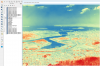
Interview with Webster Gumindoga, PhD Student at University of Twente and Lecturer at the University of Zimbabwe

Webster is a PhD student at the University of Twente’s Faculty of Geoinformation Science and Earth Observation. His PhD thesis is entitled: Observing Zambezi Basin from Space: Satellite based bias correction for hydrological modelling: Webster is also lecturer and researcher at the University of Zimbabwe’s Construction and Civil Engineering Department. He is the coordinator of the regional master’s degree programme in Integrated Water Resources Management, a capacity building programme for the water sector in Southern and Eastern Africa. His research interests are in the areas of GIS and Earth Observation applications in water resources management, sanitation, water quality and disaster management. He is also a consultant who has been seconded as a GIS mentor to many government institutions and developmental partners in Southern Africa. Webster has over 60 publications, numerous regional and international conference papers in areas of spatial and quantitative hydrology, water resources management, quantification of water cycle components and feedbacks between climate, land-uses, water cycles and other societal influences. Webster is the Chief Editor of the Journal of Environmental Management in Zimbabwe (JEMZ).

Launch of Zimbabwe's first Satellite ZIMSAT - 1

What began as the development of a cubesat (BIRD-5) at the Kyushu Institute of Technology in Japan took off on a spacecraft to the International Space Station from the Mid-Atlantic Regional Spaceport at the National Aeronautics and Space Administration's (NASA's) Wallops Flight Facility in Virginia, US on 6 November 2022 (watch the video of the launch of the CRS2 NG-18 (Cygnus) Mission (Antares), in the video below the article).

Real-time drought monitoring from Climate Hazards group Infrared Precipitation with Stations (CHIRPS)

Different parts of world are experiencing extreme hydrological hazards such as droughts, flooding and other related events. Droughts are associated with absence of rainfall occurrence over an extended period. According to the United Nations (2022), the frequency and intensity of drought events in the last two decades has increased by 29%. These figures are expected to increase further in the coming years due to climate change (Gunathilake et al., 2020). 

Interview with Joshua Ubah, Geospatial Environmental Engineer

Joshua is a Master’s student in Tropical Hydrogeology and Environmental Engineering at Technische Universität of Darmstadt. His interest is focused on hydrogeological processes, groundwater modelling, application of remote sensing and GIS in environmental studies, water management and climate change. He also works as a graduate Intern at AgriWatch BV, a company that applies geospatial solutions for precision Agriculture. As a graduate intern, he applies his interdisciplinary knowledge in developing smart-farming solutions using space-based technologies to farmers in the Twente region of the Netherlands. He deploys satellite imagery, field studies and machine learning algorithms to predict the effect of climate change on arable crops. He also utilizes precipitation data to predict rainfall events to aid farmers in determining planting and harvesting periods. Joshua earned a bachelor’s degree in Geological Sciences, his bachelor’s thesis research aimed at carrying out paleoenvironmental reconstruction using paleocurrent indicators of water flow and direction, and application of ArcGIS to produce maps. Currently, he is working on his master’s thesis with emphasis on the impact of the ancient climate on the paleoenvironment particularly on vegetation, where he tries to research plants response to long-term greenhouse periods and short-term warming events on various timescales throughout Earth's history. His research interests revolve around the application of space technologies in providing solutions and tackling climate change.

Earth observation data cubes for water resources management

Data has become one of the most valuable resources of the 21st century. Indeed, data can be considered the most important input when it comes to make informed decisions. The recent global pandemic crisis highlighted the vital role of data for reporting accurate case numbers and outbreaks, identifying the most vulnerable demographics, and understanding the most effective vaccines, to mention few. Data also plays a key role when it comes to sustainability.

Register for the 1st Space4Water Stakeholder Meeting - End or registration: 30 September

Space4Water stakeholders, featured young professionals and professionals, join us in Vienna at the 1st Space4Water Stakeholder Meeting.

Dates and location

The workshop will take place on 27-28 October 2022 at the Vienna International Centre, with an opportunity to host it online, should COVID prevent travels in October.

Registration

To be considered for participation Space4Water stakeholders and featured professionals can register here.

Register for the Participatory Workshop for Indigenous Women - apply for funding until 21 August

Are you an indigenous women or in touch with indigenous communities. Don't miss this chance to make the voices of indigenous women heard. We would like to contribute to closing the digital divide, as well as to raise the voices of indigenous women on their views realated to water and the environment.

Spread the word about this opportunity so we can reach as many Indigenous women as possible.

Call for abstracts - until 31 August - for the 5th SADC Groundwater conference

The SADC Groundwater Management Institute will host its 5th SADC Groundwater Conference on 16, 17 & 18 November 2022.

The conference is held annually, with the primary objective of providing a platform for the advancement of knowledge sharing on sustainable management of groundwater at national and transboundary levels across SADC Members States

This year the event will be physically held in Windhoek, Namibia with an online participation option.

Interview with Mastawesha Misganaw Engdaw, Research scientist at WEGC

Mastawesha Misganaw Engdaw is a research scientist with an academic background including geo-information science and earth observation, water resources management, hydrology, and climate change. His research activities include assessing the past, present, and future changes in the climate system, as well as its impacts on multiple sustainable development goals. He is particularly interested in assessing impacts of climate change on hydrological extremes and water resources management. Mastawesha is currently working on climate risk assessment and attribution of compound hydrological extreme events.

Interview with Claudia Ruz Vargas, Researcher at IGRAC

Claudia Ruz Vargas is a civil engineer, graduated from the University of Santiago, Chile, with an international master’s degree in Groundwater and Global change. Her master thesis focused on groundwater modelling for recharge and saline intrusion risk assessment under climate change scenarios, in Cape Verde. Claudia has six years of work experience as a project engineer and researcher. She is currently a researcher at the International Groundwater Resources Assessment Centre (IGRAC), where she is involved in projects of high impact on the groundwater sector. In this interview, we talked to her about her career path, and how she has contributed to an improved and more sustainable management of groundwater resources, at a regional and global levels.

United Nations/Ghana/PSIPW - 5th International conference on the use of space technology for water resources management

From 10 to 13 May 2022, the United Nations Officer for Outer Space Affairs organized the 5th International conference on the use of space technology for water resources management. The conference was hosted in a hybrid format in Accra, Ghana, by the University of Energy and Natural Resources, Sunyani on behalf of the Government of Ghana. The event was attended by several senior government representatives of the host country including Dr. Mahamudu Bawumia, Vice President of the Republic of Ghana, the Honorary Minister of Education Dr.

Interview with Margherita Bruscolini, Geospatial & Earth Scientist, Drone Pilot at RSS-Hydro

Margherita is an interdisciplinary Earth scientist and drone pilot with a background in geologic and environmental sciences. She has international experience working in fields such as Earth Observation (EO), remote sensing, drones & geospatial data analysis applied to the environmental and humanitarian sectors, sustainability and climate change. Margherita is passionate about natural and climate-related technologies that can be used to develop sustainable and long-lasting solutions. She is working for a more inclusive world (Women in Geospatial+), without any sort of geographical or social barriers. Keywords: Science communication, Climate Change, STEM, inclusivity, sustainability, nature, hydrosphere, hydrology, water risks, Earth Observation (EO), satellite data, flood modeling, vulnerability, resilience, lifelong learning  Region/Country mentioned: Temperate climates, Arid climates, Luxembourg, Niger  Relevant SDG targets: 1, 4, 6, 9, 11, 13, 17  

Monitoring hydrological changes from space in a sparse gauged basin

Africa is endowed with abundant freshwater resources. It has sufficient rainfall and relatively low levels of water withdrawals for three major uses: domestic, agricultural and industrial uses. Changes in Africa’s water resources has been noticed transpiring in changes in water flow and variability, falling groundwater levels, changes in rainfall levels and timing, strongly influenced under climate change. The continent has a huge potential for energy production through hydropower.

Interview with Dr. Ayan Santos Fleischmann, Lead, Research Group in Geospatial Analysis of the Amazonian Environment and Territory

Ayan Santos Fleischmann is a hydrologist with a particular interest in wetlands and large-scale basins, mainly in South America and Africa, and in the context of human impacts on water resources. His main study approaches involve remote sensing techniques and hydrologic-hydrodynamic modeling, as well as interdisciplinary collaborations with other disciplines such as ecology and social sciences. Currently, he is a researcher at the Mamirauá Institute for Sustainable Development (Tefé, Amazonas, Brazil), where he leads the Research Group in Geospatial Analysis of the Amazonian Environment and Territory. He also leads the Conexões Amazônicas initiative for science communication about the Amazon Basin. Ayan holds a PhD degree from UFRGS, with a collaborative period at Université Toulouse III – Paul Sabatier (France). His Ph. D. thesis focused on the hydrology of the South American wetlands. Ayan holds an Environmental Engineering degree from the Universidade Federal do Rio Grande do Sul (UFRGS), with a research stay at the University of East Anglia in the United Kingdom. In this interview, we talked to him about his career path, the work he has been developing in Brazil with wetlands and floods, and his work in the Amazon River basin.

Water management in local communities led by women

When we think about geospatial technology, many of us imagine satellites for Earth observation and navigation, drones, and complex sensors used to collect information from the terrestrial surface. We also believe that most of the people capable of developing applications using geospatial data should hold a science-related Master or Ph.D. degree. The previous statement could not be further from the truth. Advances in technology have made access to geospatial technology possible for everybody.  

Register for the United Nations/Ghana/PSIPW - 5th International conference on the use of space technology for water resources management

The United Nations Office for Outer Space Affairs (UNOOSA) and the Government of Ghana are jointly organizing a Conference with the support of the Prince Sultan Bin Abdulaziz International Prize for Water (PSIPW) to promote the use of space technology in water management to the benefit of developing countries.

The Conference will be held in Accra, Ghana, from 10- 13 May 2022, hosted by the University of Energy and Natural Resources on behalf of the Government of Ghana.

GeoHUB's scholarship in geospatial technologies

The Central European University announced their GeoHUB Project offers a special scholarship to study application of geospatial methods at CEU.

Applicants accepted to any Masters Degree at the Department of Environmental Sciences and Policy are eligible for receiving the scholarship, covering 10 months of living costs in Vienna. The candidates should be interested in application of geospatial methods in various environmental domains and undertake relevant academic activities, including courses, internships and thesis research.

Interview with Mr Stuart Crane, Programme Management Officer at UN Environment

Mr Stuart Crane, has been program coordinator at the United Nations Environment Program and its Center for Water and Environment since 2017. Mr Crane has experience in international intergovernmental organizations since 2009 and dedicated large parts of his career to working on environmental issues such as energy, climate change and water. His professional background is in Environmental Quality and resource management, and he received his post graduate degree in International Development. On behalf of UNEP, he coordinates a global SDG 6 fresh water program that supports 193 countries with progressing towards SDG. 6 targets on improving the water governance, ecosystem management and reducing freshwater pollution.

Building a Caribbean Wide Satellite Oil Spill Monitoring Program

In recent years, the Wider Caribbean Region (WCR) has faced challenges from oil spills. Despite these known risks, the WCR lacks an operational oil spill surveillance service. Oil spills, as in the case of the 2019 Brazilian incident, are often detected only after the oil has reached environmentally sensitive coastal areas, with surveillance requests sent piecemeal to government agencies in the United States and Europe. 

Aquaporins: Fighting the global water crisis using nature’s own filter

A new water-treatment technology used by astronauts aboard the International Space Station has the potential to provide clean water to millions of people worldwide. By using proteins called aquaporins, this system mimics the natural filtering abilities of human kidneys and plant roots to purify and recycle wastewater. With an increasing global water demand especially in remote locations where clean drinking water is not easily accessible, this technology has the potential to provide a more resource-efficient method of water purification not only in space, but here on Earth as well.

The advantages of applying space-based technology in monitoring and controlling water hyacinth in aquatic ecosystems

Water hyacinth is a well-known plant that has invaded many aquatic ecosystems around the globe. The fast growing nature of the weed makes it challenging to contain. The weeds’ presence in aquatic bodies results in decreased oxygen and nutrient levels, which threatens aquatic life as well as the productivity and functionality of the whole aquatic ecosystem. This not only causes ecological disturbances but evidently socio-economic challenges arise as well as the weed can be detrimental to health as well as economic activities in many riparian communities worldwide. The use of space-based technology together with modern technologies is of great significance in capturing the weed and identifying its spatial and temporal distribution even in hard to reach places. This helps scientists better understand the weed and how infestation occurs which enables better management and control of the weed.

Interview with Naledi Msiya

Describe your professional (and/or personal) experience relating to water (and space technologies). Please indicate whether an experience is related to water or to both, space and water).

I have always had an interest for science and the environment and before starting university I was introduced to hydrology which really caught my interest and led me to studying a BSc Degree in Hydrology and Geography.

The water cycle from space: the central role of satellite-informed models in corporate water management

Water in the atmosphere, in the soil, in rivers and oceans is in continuous exchange via the global water cycle. This is commonly thought to be the circular movement of water that evaporates from the Earth's surface, rises on warm updrafts into the atmosphere, and condenses into clouds. It is transported by the wind as water vapour, and eventually falls back to the Earth’s surface as rain or snow.

Call for young professionals

The Meet a Young Professional feature of the Space4Water Portal is a unique opportunity for young professionals to be interviewed and share their views with a broad community of experts. Young Professionals ideally have both, a passion for space technologies and sustainable water resource management or hydrology.

Space technologies for drought monitoring and management

The impacts of climate change are ever more apparent. The frequency and scale of devastation and destruction of weather hazards are on an increasing trend. According to the latest Intergovernmental Panel on Climate Change Report (IPCC, 2021) climate change is intensifying the water cycle. This will cause more intense droughts in many regions. Moreover, water-related extremes impact the quality of life disproportionately strong. Drought accounts for 25% of all losses from weather-related disasters in the United States of America (Hayes et al., 2012).

Interview with Arjen Haag, Researcher and Consultant in hydrology and water management at Deltares

Arjen Haag is a hydrologist and remote sensing analyst working at the Operational Water Management & Early Warning department of Deltares. We talk to him about the role that earth observation plays in his projects, SERVIR-Mekong, his experiences in the space and water sector and his vision for innovation in the remote sensing community. We ask him about challenges related to flood mapping and forecasting, whether water data should be shared openly and the transfer of knowledge to those needing it the most. He shares his insights on the use of satellite data, algorithms and models, as well as artificial intelligence and machine learning. And finally, why sandcastles were important for all of this.

Towards new applications of spaceborne technology on flood protection

Recently, in July 2021, destructive and deadly floods occurred in Western Europe. The estimated insured losses only in Germany could approach 5 billion Euros (AIR Worldwide, 2021). However, the total amount of the damage is currently not foreseeable due to the variety and complexity of the damage patterns and the unbelievable extent of the disaster. It seems the socio-economic losses will dramatically increase and break a new record in the insurance industry after evaluating the complete record of damages’ reports (see Figure 1).

Committee on the Peaceful Uses of Outer Space: 2021

The Committee on the Peaceful Uses of Outer Space in its sixty-fourth session, which took place form 25 August-3 September 2021 in Vienna, adopted the below on its agenda item "Space and water": 
 

  1. The Committee considered the agenda item entitled “Space and water”, in accordance with General Assembly resolution 75/92.

Interview with Victor Pellet, CNES PostDoc, Paris Observatory

Describe experience relating to water and space technologies

I grew up in a country (France) where water is freely available. The drought in 2003 was considered a one-time event. I had no single lesson on climate change at school. Despite this background, I was raised aware of the links between social and environmental inequality on a global scale.

How has space revolutionised subsidence?

Introduction

Land subsidence is a global phenomenon and is defined as:

“a gradual settling or sudden sinking of the Earth's surface due to removal or displacement of subsurface earth materials”  - National Oceanic and Atmospheric Administration (2021)

Call for Articles and Stories

Task

We seek the support of online volunteers to write success stories and news articles on the use of space technologies for any field which is concerned with water, e.g. water management, water cycle management, water-related topics within the realms of climate-change or ecosystems, and all sub-fields (a more exhaustive list of topics can be taken from the Guidelines for Articles and Stories - linked below). The stories and articles are to be published at the Space4Water Portal.

Interview with Benjamin Kitambo, PhD student at the Laboratory for Space Geophysics and Oceanography

Describe your professional (and/or personal) experience relating to water and space technologies.

My interest in water is a result of my background in Geology. I come from a region (Katanga Province, Congo DR) where mining is the main source of livelihood. So, I had my bachelor's degree in Geology intending to work in the mining sector after graduation. However, towards the end of the bachelor’s programme, I was exposed to the deployment of geophysical equipment for water prospecting in my department.

European Space Agency’s “Water Scarcity” Kick-Start

The challenge

Water is one of the most important substances on Earth and covers 70% of the planet. However, freshwater makes up a very small fraction with 97% being saline and ocean-based. While the amount of freshwater on the planet has remained fairly constant over time, the world’s population has exploded, meaning that freshwater is threatened by significant forces, like overdevelopment, polluted runoff, and global warming. 

GEO SDG Awards Program

Call for Nominations for the GEO SDG Awards

The 2030 Agenda for Sustainable Development provides a universal set of priorities to use as a blueprint of action for people, the planet, and prosperity. Earth observations, geospatial data, and the information they provide play insightful roles in monitoring targets, tracking progress, as well as helping nations and stakeholders make informed decisions toward achieving the Sustainable Development Goals (SDGs).

Call for local perspectives: Groundwater challenges

Local perspectives and case studies

The aim of the local perspectives and case studies feature is to learn about gaps in water resource management from affected individuals, communities, civil society, professionals, researchers or organisations in the field to identify needs or potential solutions that space technologies could contribute to.

Interview with Egline Tauya, Head of the Environment and Water Institute at SARDC

Egline Tauya has focussed her career on natural resource management, after growing up in a rural area and learning to value such resources from a young age. Her work has been based in Africa and has included the use space technologies to map flood risks and vulnerable areas around the Zambezi and Limpopo River basins. Egline develops Environmental Outlooks as part of her work, which are reports that provide an integrated assessment of the state and trends of key environmental resources, such as freshwater, forest, and wildlife. Egline strongly believes in the integration of indigenous knowledges into water resource management and the crucial, but currently limited use of remote sensing in groundwater monitoring.

Why space gardening should come down to Earth

When you think about agriculture, you probably imagine a few basic things in your mind. Huge stretches of flat land, massive harvesting machines, the heat on your skin from sunlight and, perhaps most importantly, soil. This image in your mind is a common one. Humans have been tilling, seeding, and farming land since the dawn of civilization, and modern industrial farm techniques tend to dominate our conception of agriculture. 

Space technologies in the detection, monitoring and management of groundwater

Global groundwater supplies

Groundwater accounts for 30% of Earth’s freshwater resources (Shiklomanov 1993) (Figure 1) and is estimated to globally provide 36% of potable water, 42% of irrigation water, and 24% of industrial water – indicating its significant value (Global Environment Facility 2021). Groundwater affords a host of benefits, from providing better protection against drought and microbiological contamination than surface waters, to being generally low cost and accessible to many users.

Interview with Sarhan Zerouali

Sarhan Zerouali became fascinated with water at a young age through learning about water scarcity around the world and about traditional methods for locating groundwater. In a space applications course Sahran then learnt about space-based technologies. He is currently working on a research project on how remote sensing and other technologies can help alleviate global challenges arising from land degradation. As an aerospace engineer, Sahran has worked with various modern technologies in his work including nanosatellites, artificial intelligence, and feature extraction algorithms.

The progress and potential of Sustainable Development Goal 6 and how Space Technologies contribute

Transitioning from the Millennium Development Goals (MDGs) to the Sustainable Development Goals (SDGs)

The world of WASH (water, sanitation, and hygiene) has come a long way in 30 years. Between 1990 and 2015, 2.6 billion people gained access to improved drinking water, whilst 2.1 billion gained access to improved sanitation (Unicef and World Health Organisation 2015). That’s a lot of people. But is it enough? 

Interview with Valdilene Silva Siqueira

Valdilene Siqueira has a diverse background in chemistry and environmental engineering and is currently pursing a master’s degree in Sustainable Territorial Development. Her work and experience has always been closely tied to water management and sanitation. She believes that access to water and ensuring the sustainable management of water resources in a fast-paced changing world are two of the most important challenges for the coming years. Valdilene feels that achieving mutual understanding on how to manage this resource, especially in water-scarce regions, is a real challenge for decision-makers but considers that an intersectoral, integrated and participatory approach is capable of bringing stakeholders together to reconcile their different interests and build collective solutions. 

Space for Communities: Space-based evidence to support community rights to water

Satellite imagery can be used to identify and monitor environmental and social impacts, and help solve human problems around the world. Despite rapid advancements in space-based technologies, not enough people have access to satellite data and all the insights it offers. Satellite imagery provides an objective way of verifying or validating the testimony of communities who are being impacted by social or environmental harms.

Interview with Ruvimbo Samanga

Ruvimbo Samanga, despite her age, has vast experience in the law, space, and water sectors. She is presently involved in a regional study on the integration of GIS and statistical information in Zimbabwe, working towards the promulgation of GIS standards and legislation to support a National Spatial Data Infrastructure (NSDI). Ruvimbo is excited by the merging of sustainable development for water management with space technologies because it is scalable, environmentally friendly, and cost-effective over the long run. Ruvimbo feels strongly that space technologies have a role to play in policy and legal affairs, and also sees potential especially in the use of emerging technologies such as block chain, artificial intelligence (AI) and quantum computing.

Interview with Dr. Pietro Campana

Dr. Pietro Campana studied environmental engineering with a focus on fluid dynamics, hydrology, and water resource management, before undertaking a PhD on solar irrigation systems. He is working on the water-food-energy nexus and is currently evaluating the first agrivoltaic system (a photovoltaic system that allows the combination of both electricity production and crop production on the same land to increase the land use efficiency) in Sweden. He constantly strives to work on something that can make a difference to people’s lives and finds developing tools and services that can solve water issues very exciting. He believes that to address the nexus challenges, we need novel technologies and more research and development funding.

Interview with Dr. Avid Roman-Gonzalez

Dr. Avid Roman-Gonzalez is a professor at Universidad Nacional Tecnologica de Lima Sur, teaching electronic engineering and telecommunications. He has worked extensively on the quality of satellite images and in one project used such images for post-disaster management after floods in Peru. He believes that access to such images can be crucial for monitoring water quality and pollution. For example, he was part of a team to use remote sensing images and GIS to study algal bloom pollution of Lake Titicaca, between Peru and Bolivia. To innovate, Dr. Roman-Gonzalez says one needs to think about the problems that society has and devise creative solutions for all, and believe that reading, alongside the execution of daily tasks are essential for productive work.

Interview with Basuti Gerty Bolo

Basuti Gerty Bolo dreamt of space science and of becoming an astronaut when she was only 8 years old. She then wanted to be a pilot, before studying space applications and space and atmospheric science.  Her curiosity for space science was sparked by an interest in knowing more about unexplained mysteries of things happening in space, such as the cause of some plane crashes. Basuti works exceptionally hard to disseminate space knowledge. She is an Endowed Chair for Educational Technologies at Africa University in Zimbabwe, a UNOOSA Space for Women Network mentor, and is starting a space for women and girls network called Space4Women_AfricaDreamers to spread space awareness and promote gender equality.

Interview with Lukas Graf

Lukas Graf used to take clean drinking water for granted. As he grew up, and conversations around climate change and environmental destruction became increasingly intense, he started to become more aware of the importance and scarcity of water resources. Around a similar time, he became increasingly enthusiastic about space, realising that space technologies could be used to explore many of the pressing topics that he was interested in. He has participated in research projects that used remote sensing methods to study the effects of global change on ecosystems and especially on water availability. Lukas is interested in a range of topics from virtual water and water quality to irrigation and agriculture. He believes that interdisciplinary approaches and mutual dialog with societies and stakeholders need to be deepened for sustained resource management.

Call for Articles and Stories

Task

We seek the support of online volunteers to write success stories and news articles on the use of space technologies for any field which is concerned with water, e.g. water management, water cycle management, water-related topics within the realms of climate-change or ecosystems, and all sub-fields. The stories and articles are to be published at the Space4Water Portal. The main focus of the stories shall be the benefits space technologies bring to the respective water-related field, the insights gained, data used, etc. 

Call for Young Professionals

The Meet a Young Professional feature of the Space4Water Portal is a unique opportunity for young professionals to be interviewed and share their views with a broad community of experts. Young Professionals ideally have both, a passion for space technologies and sustainable water resource management or hydrology.

Remote sensing in managing, maintaining, and understanding coral reef ecosystems

Coral reefs provide integral services to social, economic, and ecological systems. They support more than 500 million livelihoods worldwide and account for 15% of gross domestic product in more than 20 countries. A quarter of all marine species on planet Earth, representing 28 of the 35 animal phyla, can be found in coral reefs, and novel compounds derived from these organisms provide numerous useful medicinal applications.

Interview with Prof. Hesham El-Askary

Prof. Hesham El-Askary works at Chapman University in the Earth Systems Science Data Solutions (ESsDs) lab. Here, he supervises students on the use of satellite earth observations for topics including agriculture, water resources, air quality and climate action, and makes use of Artificial Intelligence (AI) and Machine Learning (ML). Prof. El-Askary is researching natural and anthropogenic pollution’s influence on the environment and is particularly interested in the concept of “glocal” impact—how what’s happening globally in terms of climate affects us locally. He believes that one of the biggest challenges in implementing sustainable water management is the lack of data to monitor progress, and advocates for space technologies to mitigates this shortage.  

Women, water and space: The first geospatial rally for women in rural aqueducts

Can you imagine a group of young women empowering other women using geospatial technology? From July 10 to 13 July 2019 in the First Geospatial Rally for Women in Rural Aqueducts took place, where 30 women from very different contexts met with the same goal, to build an empowering space, in the Nicoya Campus (north of Costa Rica) of the University of Costa Rica (UCR). This was done with the intention to learn from each other.

Hydro-diplomacy: The role of space-derived data in advancing water security

Water scarcity is one of the greatest threats faced by humanity of our time – in 2019, more than two billion people experience high water stress (UN-Water 2019) and approximately four billion people suffer from severe water scarcity for at least one month per year (Mekonnen and Hoekstra 2016). This worsening problem increases the risk of international conflict over water resources breaking out, given that there are over 270 transboundary river basins, and three-quarters of UN Member States share at least one river or lake basin with a neighbour (UN News 2017).

The impact of space-based internet communications constellations on water

Imagine a world where your internet is delivered not through cables or cell towers but a vast swarm of orbiting satellites. That world is a very different place. Political borders are no longer communication boundaries. Your phone works just as well in the US as it does in Nigeria and Australia and Cambodia. You can communicate with people on the other side of the planet near the physical limits of information transmission, unconstrained by slow cable networks.

Wastewater recycling on the ISS and in Singapore


How would you feel about drinking your own urine? To most, it is a measure that would only be taken in the direst of circumstances. However, astronauts on the International Space Station (ISS) have been drinking recycled urine every day for the past decade. In 2008, the ISS installed the Water Recovery System, a wastewater recycling device which converts urine, sweat, and atmospheric moisture into drinking water. This device has allowed the ISS to be much more self-sufficient and devices like it could serve to more sustainably produce clean water on Earth.  

Capacity Building and Training Material

Operational Systems of the SASWE

The Operational Systems of SASWE Research Group website is an online application and decision-support resource showcasing the operational tools and modelling systems developed by the SASWE Research Group at the University of Washington. It features a portfolio of satellite-based operational systems and decision support platforms designed for water resources assessment, reservoir and dam management, river basin forecasting, irrigation advisory, and hydrological monitoring.

OpenTopography online training

OpenTopography online training offers self-paced learning with video tutorials, an archive of OpenTopography webinars, Jupyter Notebook examples using OpenTopography data and processing as well as texts on the following topics:

  • What is Lidar?
  • Topographic Differencing
  • 3D Printing
  • Geologic Mapping in ArcGIS Pro
  • Potree Treasure Hunt

ARSET - Applications of remote sensing-based evapotranspiration data products for agricultural and water resource management

Overview

Evapotranspiration (ET) is the process by which the land surface returns water to the atmosphere in the form of moisture. ET is a very important part of the water cycle in the Earth system. It is the sum of evaporation from bare soil and transpiration from vegetation. For a given watershed, the supply of water from precipitation, surface and groundwater can be depleted via ET. Therefore, estimating the amount of ET is crucial for calculating the overall water budget and for effective water management.

Rapid Impact Assessment Using Open-source Earth Observation - on the example of the Kachowka Dam Break

The Jupyter notebook demonstrates how EOdal can be used for disaster relief after the break of the Kachowka using open-source Earth Observation data.

On June 6, 2023, the Kakhovka Dam in Ukraine broke. We do not yet know who or what was responsible for the collapse of the dam. What we do know, however, are the devastating consequences for the region downstream - especially for the local population.

Digital Earth Africa: Agriculture and Food Security

Digital Earth Africa learning platform

This learning platform helps users understand the significance of Earth observations, explore Digital Earth Africa datasets through an interactive map, and get started on the basics of python coding for spatial analysis.

Digital Earth Africa makes Earth observation (EO) data readily available, delivering decision-ready products to the African continent. Data generated by Digital Earth Africa will provide valuable insights for better decision-making across many areas, including resource management, food security and urbanisation.

Digital Earth Africa: Water Resources

Digital Earth Africa learning platform

This learning platform helps users understand the significance of Earth observations, explore Digital Earth Africa datasets through an interactive map, and get started on the basics of python coding for spatial analysis.

Digital Earth Africa makes Earth observation (EO) data readily available, delivering decision-ready products to the African continent. Data generated by Digital Earth Africa will provide valuable insights for better decision-making across many areas, including resource management, food security and urbanisation.

Digital Earth Africa: DEA101 - Introduction to the Digital Earth Africa Sandbox

Digital Earth Africa learning platform

This learning platform helps users understand the significance of Earth observations, explore Digital Earth Africa datasets through an interactive map, and get started on the basics of python coding for spatial analysis.

Digital Earth Africa makes Earth observation (EO) data readily available, delivering decision-ready products to the African continent. Data generated by Digital Earth Africa will provide valuable insights for better decision-making across many areas, including resource management, food security and urbanisation.

In situ calibration and validation of satellite products of water quality and hydrology

Water-ForCE is organising a community virtual workshop of experts in calibration and validation of Remote Sensing Products. This workshop is invitation-only and requires registration. The precise timing of the session slots (2-3 hours each) will be communicated once we have filled all programme slots. Each session will nevertheless take place in the early afternoon (no earlier than 1pm Central European Time) to allow speakers across the globe to join.

Water-ForCE Webinar: Water and Agriculture

Water-ForCE Webinar: Water and Agriculture

During this webinar, we will be discussing water quality (run-off from agriculture, pollution of surface water for irrigation) and quantity of water (drought, extreme rainfall, groundwater level, soil moisture) to tackle the water and agriculture domains for the Copernicus Roadmap.

Speakers:

Water-ForCE Webinar: SDG 6 clean water and sanitation

Water-ForCE Webinar: SDG 6 clean water and sanitation

While substantial progress has been made in increasing access to clean drinking water and sanitation, billions of people—mostly in rural areas—still lack these basic services.

During this webinar, we will be focusing on the targets of the Sustainable Development Goal no 6 (SDG6) on clean water and sanitation:

Speakers:

Land cover products for understanding water quality impacts

Description

Communities need to understand how land cover affects water quality. This webinar provides information about NOAA’s coastal land cover data (also known as “C-CAP data”). Several tools make these data easier to use, including the Land Cover Atlas, an online viewer used to analyze land cover changes by county or watershed. Also covered: a step-by-step guidance document that helps users understand key water quality indicators.

Introduction to Lidar

Overview

This course provides quick and flexible access to several topics needed to understand the lidar landscape, what lidar is and why it is useful for management decisions. The course features engaging video and audio, optional knowledge checks, a final quiz with certificate, and assistive services for those with disabilities.

Water: addressing the global crisis

Overview 

The SDG Academy and the Stockholm International Water Institute have come together to offer this MOOC on some of the most important water issues. They focus on the key role water plays in the achievement of the Sustainable Development Goals, not least SDG 6, about sustainable water and sanitation for all. The course intends to explain the global water crisis through linkages between water, environment, and societal development, focusing on how to tackle issues such as growing water uncertainty and deteriorating water quality.

GEOGloWS Training Platform

The GEOGloWS initiative consolidates elements of freshwater activities in GEO. It ensures that strong coordination and commitment are in place for links among data, information, knowledge, applications, and policy. From research to implementation, GEOGloWS provides the demonstration grounds for user-driven solutions to address water issues.

Geospatial Applications for Disaster Risk Management

Learning objectives

During the challenging times of the COVID-19 outbreak, MOOCs are an effective way of reaching a large number of participants to share knowledge. The United Nations Office for Outer Space Affairs and the Centre for Space Science and Technology Education for Asia and the Pacific (Affiliated to the United Nations) launched a Massive Open Online Course (MOOC) on “Geospatial Applications for Disaster Risk Management” on 13th October, 2020 the International Day for Disaster Risk Reduction.

ARSET - Mapping and monitoring lakes and reservoirs with satellite observations

Overview:

Natural lakes and man-made reservoirs are a part of Earth’s surface water. Freshwater lakes and reservoirs are used for drinking water, fishing, and recreational activities. Aside from the aesthetic and scenic value added by their presence, lakes support surrounding plant and aquatic ecosystems and wildlife. A variety of factors affect lakes and reservoirs, including climate variability and change, land use, and other watershed activities influencing surface runoff and groundwater.

ARSET - Remote sensing of coastal ecosystems

Overview:

Coastal and marine ecosystems serve key roles for carbon storage, nutrients and materials cycling, as well as reservoirs of biodiversity. They also provide ecosystems services such as sustenance for millions of people, coastal protection against wave action, and recreational activities. Remote sensing of coastal and marine ecosystems is particularly challenging. Up to 90% of the signal received by the sensors in orbit comes from the atmosphere.

ARSET - Introduction to remote sensing for coastal and ocean applications

Overview:

In this introductory webinar, participants will be provided with an overview of remote sensing for coastal and ocean applications. This will include a background in aquatic remote sensing, data access and tools for processing and analysing imagery, and examples and live demonstrations of applied science tools that have been developed for NASA and partner organizations. This course will review data products from MODIS, VIIRS, HICO, and other sensors commonly used for ocean applications.

GBDX YouTube Channel

GBDX is DigitalGlobe's Geospatial Big Data Platform which combines data access to satellite imagery with access to innovative algorithms to develop new solutions to tackle new market segments

The GBDX YouTube Channel contains useful videos for customers using the GBDX user interface, such as "How to create a workspace", "How to search for images", and "How to select materials"


ARSET - Using Earth observations to monitor water budgets for river basin management II

Overview:

Rivers are a major source of freshwater. They support aquatic and terrestrial ecosystems, provide transportation, generate hydropower, and when treated, provide drinking and agricultural water. Estimating and monitoring water budgets within a river basin is required for sustainable management of water resources and flooding within watersheds. This webinar series will focus on the use of NASA Earth observations and Earth system-modelled data for estimating water budgets in river basins.

ARSET - Applications of GPM IMERG reanalysis for assessing extreme dry and wet periods

Overview:

It is well recognized that long-term precipitation measurements are necessary for understanding and monitoring regional precipitation characteristics. This includes characteristics crucial for monitoring water resources and hazards, like floods and droughts. TRMM was the first NASA mission dedicated to observing precipitation. It operated from November 1997 to April 2015. The Global Precipitation Measurement (GPM) Mission launched in February 2014 as a follow-on to TRMM.

ARSET - Integrating remote sensing into a water quality monitoring program

Overview:

These training webinars will focus on integrating NASA Earth observations into water quality monitoring decision making processes. This will include a brief overview of data products used for water quality monitoring, an overview of aquatic remote sensing-specific criteria, methods and best practices, obtaining NASA Earth observation data for water quality monitoring, and practical skill building in image processing for water quality monitoring of coastal and larger inland water bodies. 

ARSET - Processing satellite imagery for monitoring water quality

Overview:

Polluted water influences all aspects of life, including people, animals, and the environment. NASA satellite observations provide near real-time information about water quality. This freely available data can help decision-makers in their work. Satellite data can have applications for managing drinking water, public health, and fisheries.

ARSET - Remote sensing of drought

Overview:

Prolonged drought can result in economic, environmental, and health-related impacts. In these training webinars, participants will learn how to monitor drought conditions and assess impacts on the ecosystem using precipitation, soil moisture, and vegetation data. The training will provide an overview of drought classification, as well as an introduction to web-based tools for drought monitoring and visualization.

Objective:

By the end of the training, participants will be able to:

ARSET - Groundwater monitoring using observations from NASA’s Gravity Recovery and Climate Experiment (GRACE) missions

Overview:

Groundwater makes up roughly 30% of global freshwater. It also provides drinking water for the world’s population, and irrigation for close to 1/3rd of global agricultural land. Because of this level of reliance, monitoring groundwater is crucial for water resources and land management. The Gravity Recovery and Climate Experiment (GRACE) and GRACE-Follow On (GRACE-FO) missions from NASA and the German Research Centre for Geosciences (GFZ) provide large-scale terrestrial water storage estimation from mid-2000 to present.

ARSET - River basin delineation based on NASA digital elevation data

Overview:

River basins (known as watersheds in North America) are areas of land that drain precipitation, surface water, and underlying groundwater into a river and its tributaries, eventually reaching a common outlet such as a lake, reservoir, river, or estuary. The drainage pattern is from smaller sub-basin to larger sub-basin, and from higher elevation to lower elevation. Land surface processes, precipitation, storm water, and wastewater runoff within basins have substantial impact on quantity and quality of the water draining into tributaries.

ARSET - Using Earth observations to monitor water budgets for river basin management

Rivers are a major source of freshwater. They support aquatic and terrestrial ecosystems, provide transportation, and generate hydropower. Managing river basin watersheds is critical for developing policies for sustainable water allocation and development. Over the online course of four sessions, this introductory webinar series will address using satellite data and Earth system modelling data sources to estimate surface water budgets

ARSET - Introduction to using the Variable Infiltration Capacity (VIC) hydrologic model with NASA Earth observations

Overview:

Hydrologic modeling is useful for flood, drought, and water resources management. The Variable Infiltration Capacity (VIC) Model uses inputs to better understand hydrological processes in near real-time. Many of the inputs are available from NASA remote sensing and Earth system models, allowing the model to provide soil moisture, evapotranspiration, and runoff as outputs. Together with precipitation data, these outputs provide quantitative assessment of a regional water budget.

ARSET - Introduction to remote sensing of harmful algal blooms

Obvious:

Harmful algal blooms (HABs) can have a negative impact on the ecosystem and human health. Satellite remote sensing is able to collect data frequently and over a large area to identify impaired water quality from HABs. This data can inform decision-makers on where best to put their resources for taking water samples, determine what toxins are in the water, whether they need to change or move drinking water intakes, and whether a fishery needs to be closed. Remote sensing data enables individuals and organizations to have more flexible plans for water sampling.

ARSET - Applications of remote sensing to soil moisture and evapotranspiration

Overview:

NASA's Soil Moisture Active Passive (SMAP) Satellite Mission is providing new soil moisture data, and modelling frameworks are providing new evapotranspiration data. This webinar series is intended to help participants learn about NASA soil moisture and evapotranspiration products and how to access and apply them for water resource management. Throughout the sessions, participants will learn how to monitor and manage water resources with techniques learned in training. The series begins with an introduction to satellite missions and useful data sets.

ARSET - Water resource management using NASA Earth science data

Overview:

This online course covers precipitation (rainfall and snow fraction), soil moisture, evapotranspiration, runoff and streamflow, groundwater, and lake level heights. Participants are introduced to a number of NASA data products.

Objective:

Participants will be able to use NASA remote sensing observations and land-atmosphere models to: 

GEO Knowledge Package Deep Dive - Webinar

GEO Knowledge Hub Webinar Series

The second GEO Knowledge Hub (GKH) webinar took place on Thursday 1 April 2021 from 1pm to 2pm (CET) 

Objective

The webinar covered a deep dive into the Land Use/Land Cover Classification Knowledge Package developed by the Brazilian Data Cube team at INPE. 

The webinar illustrated the journey of a Knowledge Provider, from creating a Knowledge Package through to sharing it in the GEO Knowledge Hub.

UN SPIDER Recommended Practice: Use of Digital Elevation Data for Storm Surge Coastal Flood Modelling

Overview:

Storm surges and tidal waves are global phenomena that considerably affect human populations in coastal and island regions. According to the Guide to Storm Surge Forecasting published by the World Meteorological Organization in 2011, storm surges can be defined as “oscillations of the water level in a coastal or inland body of water in the time range of a few minutes to a few days, resulting from forcing from atmospheric weather systems. According to this definition, the so-called wind waves, which have durations on the order of several seconds, are excluded”.

UN SPIDER Recommended Best Practice: Flood Hazard Assessment

Overview:

Flood hazard assessments are critical to identifying areas at risk and taking relevant preparation and mitigation measures to address the hazard. Using the HEC-RAS 2D model for preparing flood hazard maps, this Recommended Practice explains how to identify flood-prone areas and exposed infrastructure. Through its focus on the prevention and mitigation stages of the disaster management cycle, it complements the Recommended Practice on Flood Mapping and Damage Assessment with Sentinel-2, also developed by SUPARCO.

UN SPIDER Recommended Best Practice: Exposure Mapping

Overview:

Mapping the extent of a natural hazard (e.g., assessing areas with a high risk) or disaster is a first step in disaster risk management and emergency response. Subsequently, exposure mapping enables the estimation of the impact of hazards or disasters, for example, regarding the number of affected inhabitants or infrastructure. The following practice shows the use of Quantum GIS to analyze a disaster extent map in combination with auxiliary data such as population or land cover data.

UN-SPIDER Best Practice: Disaster Preparedness Using Free Software Extensions

Overview:

Remote sensing technologies can support all stages of the disaster management cycle. In the prevention and preparedness phases, they often find their application in risk assessments, scenario modelling and early warning. This UN-SPIDER Recommended Practice explains how remote sensing data about recurring floods, information about infrastructure and socio-economic data can be integrated using free and open source software to support prevention and preparedness efforts.

Webinar: Space Data Gateway - The Future of Space Connectivity and Data Delivery

Discover the fast track for on-demand, cloud-based space data provided to the private space sector, academia, and science community at a fraction of the current cost.

What to expect:

13:50 – 14:00  Online Check-in

14:00 – 14:10  Introduction

14:10 – 14:20  What is the Space Data Gateway service? - Presentation of the SDG context, purpose, and its Early Adopters’ Programme

14:30 – 14:50  Technical framework and advantages for Early Adopters (EnduroSat)

14:50 – 15:10 Q&A

Programming for Geospatial Hydrological Applications

Overview:

In this self-paced online course, the participants will be introduced to the Programming for Geospatial Hydrological Applications. Participants will learn an essential skill for researchers dealing with (spatial) data. With scripting participants will be able to better control analysis using command line tools. They can also automate their procedures by writing batch scripts. Furthermore, participants can process their data and make models using Python and its useful libraries

QGIS et Applications en Hydrologie

Le cours comprend 7 leçons. Chaque leçon présente un cas d'application, suivi d'une partie théorique SIG illustrée avec des vidéos. Ceux-ci seront suivis par un tutoriel pratique présentant les nombreuses fonctionnalités offertes par QGIS. Les leçons se terminent par des recettes de style des cartes qui fournissent une base solide dans les capacités cartographiques robustes de QGIS. Des astuces telles que les remplissages suivant la forme de polygone inversé, les paramètres d'étiquette avancés et les modes de fusion sont abordées.

Introduction to the GEO Knowledge Hub - Webinar

GEO Knowledge Hub Webinar Series

The first GEO Knowledge Hub (GKH) webinar, on the 24th February 2021, introduced the GKH in its current stage of development.

Objective

The goal was to provide a user perspective based on input from the Knowledge Providers, notably to outline GKH capabilities and benefits to the GEO community.

Topics

Topics included:

Webinar: Groundwater for Water Security in Africa

Overview

This webinar is meant to contribute to the AMCOW Pan African Groundwater Programme (APAGroP) and its various capacity building actions. The webinar is intended to support African Member States and other relevant stakeholders to develop and implement evidence-based groundwater policy and practice in Africa for improved lives and livelihoods. 

Data Recipes & Short Tutorials

Overview

Data recipes are video tutorials that include step-by-step instructions to help users learn how to discover, access, subset, visualize and use Earth science data, information, tools and services. These recipes cover many different data products across the Earth science disciplines and different processing languages/software.
 

How to Cloud for Earth Scientists

Overview 

With the impending arrival of new, high-data-volume missions, the need to effectively archive and process significantly larger data volumes will require new data management technologies and architectures that are more cost-effective, flexible, and scalable than traditional on-premises systems. To meet these needs, the Earth Science Data Systems (ESDS) Program has adopted a strategic vision to develop and operate multiple components of the Earth Observing System Data and Information System (EOSDIS) in a commercial cloud environment.

Imagery Basemaps Educational Webinars

Knowing how to choose the right foundational imagery basemap, the best way to incorporate it into your app or workflow and when to update it depends on what you’re ultimately trying to accomplish.

Objectives

Imagery Basemaps That Reflect Reality
Whether your primary use is viewing Earth to gain situational awareness, a layer for visual simulation or a foundation for advanced mapping, this webinar will help you determine:

FAO CB4WA: Use of FAO WaPOR Portal

Overview

Welcome to the open access course Use of FAO WaPOR Portal from IHE Delft Institute for Water Education and the Food and Agricultural Organization of the United Nations (FAO). WaPOR is the portal to monitor Water Productivity through Open-access of Remotely sensed derived data and has been developed by FAO. The FAO’s WaPOR programme assists countries in monitoring water productivity, identifying water productivity gaps, proposing solutions to reduce these gaps, and contributing to a sustainable increase in agricultural production.

Introduction to Modflow and Model Use

This course provides basic knowledge about MODFLOW and Model Muse, which can be used to develop, run, and post-process models. MODFLOW in Model Muse combines many of the capabilities found in MODFLOW 6, MODFLOW-2005, MODFLOW-NWT, MODFLOW-USG, and MODFLOW-LGR, and provides a platform for adding packages.

Data Sharing for Water Sector Organisations using Spatial Data Infrastructures

Overview

Integrated Water Resources Management requires exchange of data and information among sectors. Often data is stored in files on harddisks, CD-ROMs or DVDs. This makes it hard to find the data. In addition, metadata is often lacking, which makes it hard to evaluate the quality of the data and to reuse the data. A Spatial Data Infrastructure (SDI) can enable water sector organisations to improve the exchange of data within and among organisations.

Computational Hydraulics

Computational hydraulics is an applied science aiming at the simulation by computers of various physical processes involved in seas, estuaries, rivers, channels, lakes, etc. It is one of the many fields of science in which the application of computers gives rise to a new way of working, which is intermediate between purely theoretical and experimental. This discipline is not an independent development, but rather a synthesis of various disciplines like applied mathematics, fluid mechanics, numerical analysis and computational science.

Copernicus Marine Data Stream for Operational Services - Ocean Applications

Overview

This is a free virtual (online only) workshop held in English. The majority of the course is composed of self-paced learning with educational resources provided through an online learning platform called Moodle. However, instructors will also be running live training sessions in the 2nd and 3rd weeks, where participants have the opportunity to join two-hour live ‘espresso’ training sessions covering SNAP and python demos, data access, tailored workflows, and question and answer sessions for 1:1 interaction.

Water Quality Assessment

Module

This module consists of four Courses with mainly theoretical background and one Course with a final assignment. Following the DPSIR structure (Driving forces, Pressures, State, Impact and Response), we will look first at some causes and consequences of water pollution and then learn how to measure and evaluate water pollution.

Water Accounting + Online Training

Water accounting is the process of communicating water resources related information and the services generated from consumptive use in a geographical domain, such as a river basin, a country or a land use class; to users such as policy makers, water authorities, managers, etc.

The training platform includes links to freely available online training and exercises on water accounting, as well as a webinar series by ADB, IHE Delft, and recordings of relevant presentations in various languages.

Afri Alliance Knowledge Hub

The AfriAlliance project aims to better prepare Africa for future climate change challenges by having African and European stakeholders work together in the areas of water innovation, research, policy, and capacity development. Rather than creating new networks, the 16 EU and African partners in this project are consolidating existing ones, consisting of scientists, decision makers, practitioners, citizens, and other key stakeholders, into an effective, problem-focused knowledge sharing mechanism.

OGC Best Practice for using Web Map Services (WMS) with Ensembles of Forecast Data

This document proposes a set of best practices and guidelines for implementing and using the Open Geospatial Consortium (OGC) Web Map Service (WMS) to serve maps which are members of an ensemble of maps, each of which is a valid possible alternative for the same time and location. In the meteorological and oceanographic communities, it is Best Practice to produce a large number of simultaneous forecasts, whether for a short range of hours, a few days, seasonal or climatological predictions. These ensembles of forecasts indicate the probability distributions of specific outcomes.

The Potentials of Space Data

  • Objective: The last webinar introduces the audience into the space-world of data. Questions will be answered:
    • What is Space Data actually?
    • Can Space Data be linked with the satellite industry?
    • What is the impact of Space Data nowadays and what will it mean for in the future?
    • Would Space Data be the new gold?

                   Examples or case-studies will strengthen this presentation even more.

EUMeTrain

EUMeTrain is an international project, founded and financially sponsored by EUMETSAT, and dedicated to the development of satellite meteorology training resources and training methods.

Event

Participatory workshop for indigenous women on their roles and responsibilities related to water

Event Banner

register here until 21 August 2022 - if you would like to be considered for funding

In many places around the world women are responsible for water collection, a responsibility that globally takes them 200 million hours annually. It often leaves them with little to no time for school, work or to spend time with their family. Furthermore, indigenous communities' cultural heritage and knowledge about natural resources, including water, urgently needs to be considered and protected.

The Prince Sultan Bin Abdulaziz International Prize for Water (PSIPW) 9th Awards Ceremony

PSIPW 9th Award (2020)

The Prince Sultan Bin Abdulaziz International Prize for Water (PSIPW) is an international award focusing on water-related scientific innovation and judged by leading scientists from around the world. Five prizes are bestowed every two years.

This event is being held virtually in conjunction with the United Nations General Assembly High-Level Meeting on the “Implementation of the Water-Related Goals and Targets of the 2030 Agenda.”

Local Perspectives Case Studies

Geospatial Analysis of Climate Change induced Drought using NDVI and LST

picture
Ethiopia, like many developing countries, faces significant threat from droughts triggered by climate change. The country's heavy reliance on agriculture for production, export revenues, and employment makes it highly susceptible to climate change-induced challenges, such as frequent floods, droughts and rising temperatures. Therefore, this research aims to assess drought-prone areas in Meyo district, Borena Zone, thereby contributing to the attainment of SDG 13.1 and the creation of a more resilient and sustainable future in the face of climate change. To achieve the objective, the study employs the Normalized Difference Vegetation Index (NDVI) and Land Surface Temperature (LST) as indicators and the drought risk map was developed using weighted overlay analysis. Landsat images and rainfall datasets from December in the years 2002, 2012, and 2022 were analyzed to track changes. The result reveals a clear inverse relationship between NDVI and LST, where higher temperatures coincide with decreased NDVI values, signifying vegetation stress caused by reduced water availability. The study also highlights the deficient rainfall and high drought vulnerability in the norther and eastern parts of the study area. The provided drought risk map classifies areas into Low, Moderate, and High risk, illustrating the evolving drought scenario and it signifies increasing severity of drought risk in recent years, particularly from 2012 to 2022. The finding holds vital information for decision-makers, policymakers, and stakeholders in devising effective strategies to mitigate the adverse effect of drought and build resilience in the of climate change.

Decline in groundwater levels and quality

Photo of a cenote in Merida Yucatan, CC license
Decline in groundwater quality is the challenge I have observed and experience in my country. Groundwater systems are particularly important in places where no rivers flows on the surface. In Yucatan, Mexico, for example, there are no rivers on the surface but we can find the Yucatán Peninsula Aquifer one of the biggest aquifers in the world. Today, the peninsula only has a population of 2 million, yet groundwater is being overexploited and polluted. In the peninsula, all socio-economic sectors rely directly or indirectly on groundwater. The main users – agriculture and industry – are causing high levels of pollution and severely overexploiting the cenotes. The quality of groundwater is also being affected by the construction of roads, buildings and other modifications that include pumping wells, infrastructure for tourism and the use of technology to extract and modify groundwater. In addition, warmer temperatures and increasingly unpredictable rainfall during the year are making it harder to store water. Another factor is that the large number of cenotes and lack of reliable hydrological data are making it difficult for users to monitor and control their usage of groundwater. Consequently, the population faces a greater risk to its groundwater reserves than is currently recognized. I would like use time–space evidence from the natural and social sciences for Earth information systems, but to find approaches to better integrate Indigenous knowledge and in situ observations from local communities that can be used to identify/estimate parameters that can support the management of aquifers.Y

Women and their everyday lives related to Water: Joy Marie Lawrence from Cape Town

Dry soil
The City of Cape Town is a coastal city that was facing severe water shortages. In Cape Town,  water is sourced from the surrounding dams which collect the rain fall water from the mountains. Water is pumped via a distribution network to households and businesses. In 2018 and 2019 water supply was severely disrupted due to limited rain fall during the winter rainfall season. The dams were running dry and there was a concerted effort from the local government and national government about the water shortages in Cape Town and some parts of the country. As a consequence, water distribution was severely reduced to prevent the dams from running dry - which at a particular point the dams were as low as 10 per cent of capacity. Water users (residents, businesses, and industries) were urged to use water efficiently and avoid overconsumption; if not, there were penalties introduced for overuse. The citizens were subjected to water cuts and had to resort to bottled water or collect water from the tankers for drinking. Greywater use was encouraged for irrigating food and non-food gardens, flushing toilets, cleaning vehicles etc. Water use for recreational purposes was banned and alternative supplies of water were transported via tankers to Cape Town. The City also tried a temporary de-salination plant at huge costs as a means of getting drinkable water to citizens. After a good raining winter season in 2020, the dams are moderately full again but the risk of another drought is ever present. There are surrounding aquifers however the quality of the water has not been fully assessed, more technical data will assist in this regard.

Need for water quality data to monitor effects of mining and industrial use of water near Lake Athabasca, Canada

Tar Sands - Photo by Garth Lenz
The community is nestled on the northwest shore of Lake Athabasca and downstream of tar sands/mining extraction and hydroelectric dams. The challenge the community faces is the lack of data on the industry water use and how that is or will affect the community in the future. There is a need for data that will help with informed decision making for active stewardship and monitoring. We have estimated that it will cost about 17 billion dollars in liability if reclamation and remediation is not done to bring back the boreal ecosystem. Therefore, we need data to aid in decision-making and adaptive management to determine whether the current management practices and solutions are effectively working. This could be data on biodiversity, for example of benthic vertebrates to access the health of the water ecosystems and also water quality. Currently we do not have such data. Right now, they are doing progressive reclamation where they are revegetating as they are mining but we cannot evaluate whether this is successful or not. We do not know if the species they are using for revegetation are improving environmental quality or not. We need to develop criteria to determine the success of reclamation by evaluating if specified targets are met with a particular time period and if these are not met then identify what could be done differently – adaptative management.

Project / Mission / Initiative / Community Portal

GloFAS Global Flood Monitoring

In 2021, a new operational, near real-time global flood monitoring (GFM) was integrated into GloFAS. The GFM product is part of the EU’s Copernicus Emergency Management Service and is operated by EODC. The new GFM provides a continuous monitoring of floods worldwide by immediately processing and analyzing all incoming Copernicus Sentinel-1 Synthetic Aperture Radar (SAR) satellite data. Being a fully automated system, one of the strengths of the GFM is the high timeliness of its products.

EO AFRICA R&D Facility

The EO AFRICA R&D Facility, the flagship of the ESA EO AFRICA initiative, aims at strengthening an African-European research partnerships and support the sustainable adoption of Earth Observation (EO) and space-related technologies across Africa. Its primary focus is to contribute to the continent’s digital transformation by addressing critical challenges and knowledge gaps, particularly in food and water security. To achieve this, the Facility promotes collaborative research and implements a comprehensive, user-driven capacity development program.

Hydrography90m: A new high-resolution global hydrographic dataset

In tandem with the monumental increase in geo-data availability from remote sensors, field sensors and various publicly available environmental datasets, state-of-the-art geoinformatics algorithms have evolved to harness earth science data as never before. In the field of computational hydrology, these processes have yielded global information in fine detail, and of exceptional precision.

Alpine Drought Observatory

Droughts are becoming an increasing concern in the Alps and in the lowland areas that receive Alpine water. The Alpine Drought Observatory (ADO) provides a tool for a quick and easy overview of the current drought situation in the Alpine region and past drought situations in the last 6 months as maps and the last 40 years as timeseries.

Socio-groundwater toolbox

To date, hydrological issues are playing a key role in the implementation of the goals in which water has a crosscutting role linked to many other Sustainable Development Goals (SDG’s) set in the 2030 Agenda. According to SDG 6, there is a need to monitor eight different interrelated targets globally. At present, several global tools and initiatives for water monitoring exist. A prerequisite for their implementation is to have a thorough knowledge of the system and a consistent database, usually collected at a country and global scale worldwide.

WMO Hydrological Observing System Portal

Currently, WHOS makes available three data portals allowing users to easily leverage common WHOS functionalities such as data discovery and data access, on the web by means of common web browsers. For more information on WHOS data and available tools, please refer to the Section WHOS web services and supported tools.

WHOS-Global Portal provides all hydrometeorological data shared through WHOS. WHOS-Global Portal is implemented using the Water Data Explorer application.

Healthy Rivers for All Initiative

This website includes tools and resources for developing basin report cards. It includes reports that incorporate satellite imagery to measure environmental indicators and change over time.

With the University of Maryland Center for Environmental Science (UMCES), we are developing, packaging, and sharing a process that helps stakeholders create science-based report cards in their own basins with the right buy-in on-the-ground and credibility globally, so they can better manage resources for the protection of fresh water they depend upon.

Water scenarios For Copernicus Exploitation

The Water-ForCE project will co-create a Roadmap for the development of the next phase of Copernicus Inland Water Services with the space sector, research community, policy, industry and third sector. The Roadmap will be benchmarked against community requirements, recommending services that should be delivered centrally by Copernicus and innovation opportunities that are better suited for business and research development.

Space-Enabled Modeling of the Niger River to Enhance Regional Water Resources Management

River and floodplain landscapes are constantly undergoing change due to natural and manmade processes putting pressure on fluvial systems, such as reservoirs, intensive agriculture, high-impact repetitive droughts and floods and the overall effects of climate change. All these bring about considerable changes, some of which irreversibly degrade ecosystem services, local economies and impact lives, particularly in sensitive transitional zones such as the Sahel region in Africa and its Niger River Basin (NRB).

MarineAware

MarineAware is a modelling and visualisation platform for identifying and responding to oil spills at sea. It was developed by Riskaware for the Earth and Sea Observation System (EASOS) project as part of the UK Space’s Agency’s International Partnership Programme (IPP). Since it's initial development for the EASOS project, MarineAware and its modelling output have been used by the UK, US and Malaysian governments, as well as by commercial response and salvage companies in Africa, Asia and the Middle East.

Water Accounting +

Water problems around the world are increasing; however, information useful for decision makers within the water sector and related to the water sector seems to be decreasing. Solving water problems requires information from many disciplines, and the physical accounts (describing sources and uses of water) are the most important foundation. The information has to be coherent and harmonized in order to provide an integrated picture useful for the assessment of the problems.

Africa-EU Innovation Alliance for Water and Climate

The AfriAlliance project aims to better prepare Africa for future climate change challenges by having African and European stakeholders work together in the areas of water innovation, research, policy, and capacity development. Rather than creating new networks, the 16 EU and African partners in this project are consolidating existing ones, consisting of scientists, decision makers, practitioners, citizens, and other key stakeholders, into an effective, problem-focused knowledge sharing mechanism.

e-shape

e-shape is a unique initiative that brings together decades of public investment in Earth Observation and in cloud capabilities into services for the decision-makers, the citizens, the industry and the researchers. It allows Europe to position itself as global force in Earth observation through leveraging Copernicus, making use of existing European capacities and improving user uptake of the data from GEO assets.  EuroGEO, as Europe's contribution to the Global Earth Observation System of Systems (GEOSS), aims at bringing together Earth Observation resources in Europe.

Global Gravity-based Groundwater Product

Groundwater is an essential factor for ecosystems and humanity alike. It ensures ecosystem stability, energy and food security, and promotes human health. Groundwater is the largest component of global liquid freshwater resources in the water cycle, providing about 30% of the total freshwater. Groundwater accounts for 33% of the global water withdrawals by mankind, with more than two billion people depending on groundwater as primary water resource. However, despite its importance, groundwater is often not included in sustainable water management actions and plans.

OneAtlas

OneAtlas is a unique collaborative environment to easily access premium imagery, perform large-scale image processing, extract industry specific insights and benefit from Airbus assets to develop your solutions.

Thematic focus is on the usage of satellite derived geo information.

GPM/DPR : Global Precipitation Measurement/Dual-frequency Precipitation Radar

The 21st century is often called "the century of water." Water is an essential element of the Earth's environment and is indispensable for our life and economic activities. Many places in the world now face water problems, such as water shortages and floods, which can cause food shortages, epidemic diseases, and so on. In addition to these problems, global warming and climate change affect the global water cycle and result in abnormal weather, such as frequent heavy rains and droughts.

Stakeholder

Shanghai Jiao Tong University

Shanghai Jiao Tong University is one of the famous institutions of higher learning with the longest history and reputation at home and abroad. It is a national key university directly under the Ministry of Education and jointly built with Shanghai Municipality. After 128 years of unremitting efforts, Shanghai Jiao Tong University has become a domestic first-class and internationally renowned university, and further defined the vision on constructing a “comprehensive, innovative and international” world-class university.

Geodesy Group - Aalborg University

Located in two beautiful cities of Aalborg and Copenhagen in Denmark, the Research Group of Geodesy provides unique scientific research related to theoretical and applied geodesy. Our researchers address many urgent concerns facing the world today including the climate change, and address the demands to improve the efficiency of Earth System, Water Cycle, Atmosphere, and Geophysical models for real-world applications. Our research covers both the aspects of fundamental theoretical and practical geodesy.

German Aerospace Center

The German Aerospace Center (DLR) is Germany's research and technology center for aerospace. It conducts applied and basic research for these industries and also conducts research in the fields of energy, transportation, security, and digitalization.

Earth Observation Data Centre for Water Resources Monitoring GmbH

Earth Observation Data Centre for Water Resources Monitoring GmbH (EODC) was established in 2014 as a direct response to the huge increase of satellite data volumes. To tackle the data streams, it has implemented an IT infrastructure and software service that supports storage, processing and re-distribution of EO data. This capability is offered to several Copernicus services, national and international research projects as well as to the private sector.

Stockholm International Water Institute

Stockholm International Water Institute (SIWI) is a not-for-profit institute with a wide range of expertise in water governance related to water resources management and water diplomacy. Thanks to our multi-disciplinary approach, we can strengthen policy and extend reach via our international programmes, projects, and multi-stakeholder platforms. These activities allow us to innovate and develop applied knowledge and tools for water governance and to offer policy advice to countries, communities, and companies.

Global Water & Sanitation Center

The Global Water & Sanitation Center (GWSC) was formally established in 2022, a legacy of Gates Foundation (GF) and the Asian Institute of Technology’s (AIT) partnership to host and mainstream citywide inclusive sanitation (CWIS) and advance the WASH agenda in South and Southeast Asia. Its mission is to ensure universal access to safe, inclusive, and sustainable WASH services for all in Asia and beyond. In its efforts, the center contributes to achieving several key Sustainable Development Goals (SDGs).

Wolkite University

Wolkite University is a public higher education institution located in the city of Wolkite, in the Gurage Zone of Ethiopia. Established in 2012, the university has quickly grown to become a center of learning and research in the region. It is committed to providing quality education, conducting research, and offering community services. 

Highlights: The university is known for its strong emphasis on research and innovation. It has established collaborations with various national and international institutions to enhance its research capacity. 

UK Centre for Ecology and Hydrology

The UK Centre for Ecology & Hydrology (UKCEH) is a world-leading independent research institute focused on delivering integrated environmental science to address some of the most pressing challenges facing society and the planet. With over 50 years of expertise, UKCEH operates at the interface of ecology, hydrology, atmospheric science, and data science, providing evidence and tools to support sustainable environmental management.

Institute of Ionosphere

The Institute of Ionosphere is a national scientific research institution operating under the Aerospace Committee of the Ministry of Digital Development, Innovation and Aerospace Industry of the Republic of Kazakhstan. Since its foundation in 1961, the Institute has evolved into a multidisciplinary center focused on ionospheric physics, atmospheric science, geospatial technologies, and environmental monitoring using satellite data.

Institute of Water Resources Planning

The Institute of Water Resources Planning (IWRP) is a leading research and consulting organisation under the Ministry of Agriculture and Environment of Vietnam. With a strategic focus on integrated water resources management, IWRP plays a pivotal role in advancing sustainable solutions for agriculture, ecosystem conservation, and climate resilience. The institute leverages cutting-edge space technologies, including remote sensing and geospatial modeling, to support evidence-based planning and decision-making.

Chemichemi Foundation

Chemichemi Foundation exists to build capacity on climate resilience and governance. Our beneficiaries include youth, women, persons with disabilities, indigenous peoples and local communities and marginalized groups. #ResilientSocieties

Geomatics Research Group at the Institute of Geography of the Ruhr-University Bochum

Located in the center of the dynamic Ruhr metropolitan region, the Ruhr University, with its 21 faculties, is home to 41,600 students from over 130 countries studying one of the 61 Bachelor and 128 Master programs. "Built to Change" is the guiding principle of the Ruhr University. Since 1965, it has been the driving force behind the transformation from a mining district to a knowledge region.

University of Surrey

The University of Surrey is a leading research and higher education institution in the United Kingdom, known for its strengths in space technology and water research, among other fields.

Directorate of Resource Surveys and Remote Sensing, Kenya

The Directorate of Resource Surveys and Remote Sensing (DRSRS) is a key government agency in Kenya, established in 1977 under the Ministry of Environment and Natural Resources, but now under the Executive Office of the President. DRSRS is renowned for its work in mapping and monitoring natural resources and environmental changes through advanced remote sensing and GIS (Geographic Information Systems) technologies.

University of Birmingham: Resilient Systems and Climate Action Group

The University of Birmingham, a leading global research university in the United Kingdom, is renowned for its multidisciplinary expertise in addressing complex global challenges. With a strong commitment to sustainability and innovation, the University conducts pioneering research in water resources, climate resilience, and satellite technology applications.

eoVision

eoVision GmbH comprises the two business areas eoVision Media and eoVision Consulting. While eoVision Media can be described as a start-up company, the company has been active in the geoinformatics and remote sensing business for many years.

Stimson Center

The Energy, Water, & Sustainability Program at the Stimson Center addresses important and timely policy issues and technical opportunities concerning energy, water, and sustainable development in the Global South from a multidisciplinary perspective.

Our work on transboundary river basins identifies pathways towards enhancing water security and optimizing tradeoffs between water, energy, and sustainable development options in the Mekong, Ganges-Brahmaputra, Indus, Aral Sea and Euphrates-Tigris river basins.

CREA Hydro&Energy

CREA Hydro & Energy is a cluster operating in the field of technologies for water management works, water and waste management and renewable energy sources. The members of the cluster jointly participate in research, development and innovation of products, promotion of the latest know-how, or presentations within the framework of international cooperation.

Czech Hydrometeorological Institute

The CHMI is a central state institute of the Czech Republic with long-term extensive expertise and competence in weather forecasting, meteorology, climatology (including climate change research), air quality (monitoring and research of pollution in the ground layer of the atmosphere), hydrology (drought and flood forecasting, evaluation and research) and water quality.

mWater

mWater is a woman-owned small business with a non-profit arm for projects with international organizations and foundations, and a for-profit arm for US Government and private sector clients. Our staff includes senior experts with advanced degrees in environmental engineering, public health, and technology, allowing mWater to create innovative, data-driven management approaches for our partners and all users of the free mWater technology platform.

Federal University of Technology Akure, Nigeria

The Federal University of Technology, Akure (FUTA), a top-ranking university of technology in Nigeria and indeed the nation's pride. Established in 1981, the university has grown tremendously, stretching its academic disciplines and research across eight different schools and over fifty academic departments.

Vision

To be a world-class University of Technology and a centre of excellence in training, research and service delivery

Institut des Regions Arides

The Institut des Regions Arides (IRA) (Arid Regions Institute) was established in 1976 and it is currently under the umbrella of the Ministry of Agriculture, Hydraulic Resources and Fisheries. It is headquarted in El Fje, Médenine with regional stations in Gabes, Ben Guerdane, Kebili and Tataouine in southern Tunisia. The main mandates of IRA are:

Hydrosat Inc.

Hydrosat is a climate tech company that was founded to help Earth manage its most valuable resource: water. Hydrosat leverages the unique capabilities of thermal imagery from space to measure water stress in agriculture and enhance food security, public safety and the environment.

National Institute for Space Research

Strategic objectives

  1. Expand and consolidate skills in science, technology and innovation in the areas of space and the terrestrial environment to respond to national challenges.
  2. Develop, on a global scale, scientific and technological leadership in the areas of space and the terrestrial environment, emphasizing Brazilian specificities.
  3. Expand and consolidate skills in weather and climate forecasting and global environmental changes.
  4. Consolidate INPE's performance as a unique institution in the development of satellites and space technologies.

American University of Central Asia

Founded in 1993, AUCA develops future leaders for the democratic transformation of Central Asia. American University of Central Asia is an international, multi-disciplinary learning community in the American liberal arts tradition. AUCA is the first university in Central Asia to offer US accredited degrees in liberal arts programs through a partnership with Bard College in the United States. In addition to Bard, AUCA maintains partnerships with a number of universities and organizations worldwide.

University of Natural Resources and Life Sciences Vienna

Founded in 1872, the Universität für Bodenkultur Wien / University of Natural Resources and Life Sciences, Vienna, also known by its acronym "BOKU" is an education and research institution for renewable resources in Vienna, Austria. Today, BOKU comprises of 15 departments located at two sites in Vienna and one in Lower Austria, as well as several external research and teaching facilities in Austria. There are currently approximately 11000 students enrolled at BOKU in study courses at the bachelor, master, and doctoral levels.

Margosa Environmental Solutions

Margosa develops pioneering geodata solutions using advanced open source technologies and machine learning frameworks, which enables the integration of massive environmental and GIS datasets. We offer cost-effective, scalable, and secure global data analytics platforms for government, multilateral, corporate, educational, and not-for-profit institutions. Our mission is to transform complex natural resource information into practical knowledge for decision-makers and stakeholders alike.

Agencia Bolivariana para Actividades Espaciales / Bolivarian Agency for Space Activities

The Bolivarian Agency for Space Activities (Agencia Bolivariana para Actividades Espaciales, ABAE) is the Venezuelan Space Agency, which was established on 25 October 2007 by the Venezuelan government. According to the rules and regulations set forth by the Ministry of Popular Power for Science and Technology, the acronym ABAE refers to the national entity in charge of managing space programs, projects, and activities. The ABAE is in five different locations in the country:

The United Nations University Institute on Comparative Regional Integration Studies (UNU-CRIS)

The United Nations University Institute on Comparative Regional Integration Studies (UNU-CRIS) is a research and training institute of the United Nations University. UNU is a global network of institutes and programs engaged in research and capacity development to support the universal goals of the UN. It brings together leading scholars from around the world with a view to generate strong and innovative knowledge on how to tackle pressing global problems. UNU-CRIS focuses on the study of processes of global cooperation and regional integration and their implications.

African Association of Remote Sensing of the Environnement

The African Association of Remote Sensing of the Environment (AARSE) was founded in 1992 and was incorporated as an international NGO under Section 21 of the South African Companies Act (Act 61 of 1973). AARSE is a partner of many international organizations such as the International Society for Photogrammetry and Remote Sensing (ISPRS) and the IEEE Geosciences and Remote Sensing Society (GRSS), and a participating organization of the Group on Earth Observations (GEO).

National Water and Sanitation Agency of Brazil

The National Water Agency (ANA) is legally liable for implementing the National Water Resources Management System (SINGREH), created to ensure the sustainable use of our rivers and lakes for the current and future generations. This implies regulating the use of water according to the mechanisms established by Law No.

Bahrain Space Agency

The Bahrain Space Agency (BSA) seeks to establish a sound infrastructure for the observation of outer space and the earth, make Bahrain a leader in space science and technology, build a culture and methodology of scientific research within the kingdom and encourage technical innovation, among other goals. BSA is interested in satellites to obtain data, to use them for remote sensing and to conduct advanced space research, so it can be the engine for the state in the use of the latest satellite communication technologies.

BSA’s main projects are as follows:

University of Twente - Faculty ITC

The Faculty ITC of the University of Twente is among the world's top ten institutes for academic education, scientific research and technology development in Earth Observation and Geo-information. ITC staff is engaged in building capacity in the fields of food/water security & agriculture, energy transition, geo-health, climate change adaptation, urban development and smart cities, disaster risk reduction, and land administration.

Center for Space Science and Geomatics Studies (CSSGS), Pashchimanchal Campus, Institute of Engineering (IOE), Tribhuvan University

The Center for Space Science and Geomatics Studies (CSSGS) is the research center with a focus on space science and geomatics applications in the following themes: disaster management, water quality, glacier, precision agriculture, air pollution, water pollution. Research areas also focus on the application of Global Navigation Satellite System (GNSS) in forestry, agriculture and engineering.

Govind Ballabh Pant University of Agriculture and Technology Pantnagar

G. B. Pant University of Agriculture and Technology, also known as Pantnagar University, is the first agricultural university in India. The University lies in the campus town of Pantnagar in Kichha Tehseel and in the district of Udham Singh Nagar, Uttarakhand. The university is regarded as the harbinger of the Green Revolution in India. Pantnagar University is regarded as a significant force in the development and transfer of High Yielding Variety of seeds and related technology.

Kenya Space Agency

The Kenya Space Agency (KSA) was established under the Ministry of Defence, as the successor to the National Space Secretariat (NSS), by Executive Order through Legal Notice No. 22 of 7th March 2017 with the mandate to promote, coordinate and regulate space related activities in the country.
Vision: The vision of the Agency is to be the premier Space Agency in promotion of access and effective utilization of Space Economy for national sustainable development.

Remote Sensing, GIS and Climatic Research Lab, University of the Punjab

The emerging demand of GIS and Space Applications for Climate Change studies for the socio-economic development of Pakistan along with Government of Pakistan Vision 2025, Space Vision 2047 of National Space Agency of Pakistan, and achievement of UN Sustainable Development Goals (SDGs) impelled the Higher Education Commission of Pakistan (HEC) to establish Remote Sensing, GIS and Climatic Research Lab (RSGCRL) at University of the Punjab, Lahore, Pakistan.

Egyptian Space Agency

Egyptian Space Agency is a Governmental Organization that's aiming at acquiring Space Technology and Satellite Launching capabilities towards the accomplishment of The National Sustainable Development Strategy "Egypt-SDS 2030" objectives.

International Research Center of Big Data for Sustainable Development Goals

With the aim of addressing global challenges in the implementation of the 2030 Agenda for Sustainable Development, CBAS is committed to harnessing big data to support the Sustainable Development Goals (SDGs) by reducing technological barriers and filling in data gaps. Since its inauguration, CBAS identified key areas of interest and has made significant progress. 

World Meteorological Organisation

As a specialized agency of the United Nations, WMO is dedicated to international cooperation and coordination on the state and behaviour of the Earth’s atmosphere, its interaction with the land and oceans, the weather and climate it produces, and the resulting distribution of water resources.

Turkish Space Agency

Turkish Space Agency (TUA) is a state institution which is responsible for the preparation of the strategic plans governing the medium and long term goals on aeronautics and space technologies, basic principles and approaches, objectives and priorities, performance indicators as well as the methods to achieve these goals and the distribution of resources. 

TUA is the face of Turkiye in space. Its mission is to be a leading and pioneering institution that carries out activities serving to the best interests of humanity in accordance with the requirements of the “New Space Age”.

University of Energy and Natural Resources

The University of Energy and Natural Resources (UENR) was established by an Act of Parliament, Act 830, 2011 on December 31, 2011. The University is a public funded national institution which seeks to provide leadership and management of energy and natural resources and be a centre of excellence in these critical areas.

Zimbabwe National Geospatial and Space Agency

The Zimbabwe National Geospatial and Space Agency (ZINGSA) is a wholly owned Government of Zimbabwe entity, established under the Research act [Chapter 10:20]. It is responsible for designing, promoting, coordinating and conducting research and development initiatives that promote advances in Geospatial Sciences and Earth Observations, Space Engineering, Space Science, Aeronautical Engineering, Mechatronics, Satellite Communication Systems, Global Navigation Satellite Systems (GNSS), Land Positioning Systems, Unmanned Aerial Vehicles (UAV) and Launch of Satellites.

GLOBHE

Drone data collection has never been easier. From anywhere. Globhe is the global platform for drone data, with more than 7600 local drone operators in 132 countries. We are fortunate to have an LTA with the United Nations and support many different UN agencies' operations throughout the world, working on water risks reduction, drone mapping, disaster management, and search and rescue, among other topics.

Globhe offers earth observation data by drones in an industry-wide revolutionizing business model, offered either by subscription or on-demand for proof of concept purposes.

Satsense Solutions Limited

Satsense Solutions Limited is a start-up company that uses satellite earth observation to develop business and governance solutions addressing the challenges of resource management, climate change and sustainable development. It has developed and deployed several applications in the Water Resources, Hydropower, Mining and Infrastructure sectors. These include assessments of eutrophication levels in lakes and reservoirs and sedimentation rates at hydropower plants. Identification of pollution in rivers, acid mine drainage and tailings at mining sites.

World Wildlife Fund

As the world’s leading conservation organization, World Wildlife Fund works in nearly 100 countries to tackle the most pressing issues at the intersection of nature, people, and climate. We collaborate with local communities to conserve the natural resources we all depend on and build a future in which people and nature thrive. Together with partners at all levels, we transform markets and policies toward sustainability, tackle the threats driving the climate crisis, and protect and restore wildlife and their habitats.

Community water and Sanitation Agency

The Organisation is a Government agency in charge of providing portable drinking water and water related sanitation services to rural communities. The agency is incharge of achieving WASH related SDGs by 2030 at the remote communities in Ghana.

Digital Earth Africa

Digital Earth Africa is empowering countries across Africa with Earth observation to enable climate adaptation and mitigation, greater food security and more sustainable development.

DE Africa offers an operational data infrastructure making current and historical, analysis-ready satellite data freely available and openly accessible for the entire continent. This further enables turning raw data into decision-ready products to inform policy and drive action.

Flemish Institute for Technological Research-Remote Sensing

VITO is an independent, research, technology & service leader in cleantech and sustainable development. Our goal? To accelerate the transition to a sustainable world, consulting & supporting public organizations, researchers & industry. VITO Remote Sensing has a long-term expertise in the development of Earth observation (EO) instruments, technologies and services. VITO plays a primary role in collecting and processing Earth observation data into objective and useful information and insights, that are actively made available and promoted.

University of Zimbabwe: Department of Construction and Civil Engineering

The Department of Construction and Civil Engineering at the University of Zimbabwe is one of the 8 departments in the Faculty of Engineering and Built Environment.The department is already a major center for water and sanitation engineering through its MSc programmes which have produced graduates from eastern and southern Africa. The department also boasts of soil and material and timber research facilities which can be used to benefit the country at large.

University of Salzburg Department of Geoinformatics Z_GIS

The Department of Geoinformatics – Z_GIS at the University of Salzburg is a well established centre of competence in GIScience, active in research and education in collaboration with academic and industry partners from the geospatial sector. At the same time, our team of Geoinformatics specialists contribute their skills and expertise to study programmes and research at Salzburg University as well as a range of international partner organisations.

The department is divided into the following divisions:

Global Water Partnership

The Global Water Partnership (GWP) is a global action network with over 3,000 Partner organisations in 179 countries. The network has 69 accredited Country Water Partnerships and 13 Regional Water Partnerships.

The network is open to all organisations involved in water resources management: developed and developing country government institutions, agencies of the United Nations, bi- and multi-lateral development banks, professional associations, research institutions, non-governmental organisations, and the private sector.

Geohazard Risk Mapping Initiative

The Geohazards Risk Mapping Initiative is an initiative that deploys volunteer youths, who are skilled at using Geographic Information Systems and satellite imagery analysis to create flood susceptibility and post-disaster maps in Nigeria.

RSS-Hydro

Diverse and dynamic R&D company operating across geospatial fields for a more sustainable future - Earth Observation, remote sensing, drones, and modelling of water risks. We are determined to make the world a more sustainable and resilient place, including the SDG targets 1, 2, 6, 13, 15, and 17 in our mission and daily activities. We offer:

Riskaware

Riskaware are experts in incident modelling solutions. Our dedicated team of software engineers, scientists and developers work closely with government and organisations globally to provide actionable intelligence and incident modelling.

Our work spans urban, cyber, marine and bio environments and is built on more than 20 years’ experience working with UK and US government departments within defence, intelligence and environmental.
 

GEO - Global Water Sustainability

Established in 2017 by the Group on Earth Observations - Water Community, GEOGloWS is a voluntary mechanism created by informal agreement among multiple partners from inside and outside the UN system. This mechanism allows for engagement and greater integration with trans-national organizations and agencies with water responsibilities at the National and Local levels.  

UK Space Agency - International Partnership Programme

The UK Space Agency’s International Partnership Programme (IPP) is an award-winning >£150 million space for sustainable development initiative which utilises the UK space sector’s capabilities in satellite technology and data services to deliver measurable and sustainable economic, societal and/or environmental benefits in partnership with developing countries.

United Nations World Food Programme

The World Food Programme is the world’s largest humanitarian organization, saving lives in emergencies and using food assistance to build a pathway to peace, stability and prosperity for people recovering from conflict, disasters and the impact of climate change.

Congo Basin Water Resources Research Center

The Congo Basin Water Resources Research Center, CRREBaC's mission is to contribute to the sustainable management and development of water resources in the Congo basin, through research to provide scientifically acceptable information and viable solutions to emerging water resource problems.


Deltares

Deltares is an independent institute for applied research in the field of water, subsurface and infrastructure. Throughout the world, we work on smart solutions, innovations and applications for people, environment and society.

Laboratoire d’Etudes du Rayonnement et de la Matière en Astrophysique et Atmosphères

The LERMA (Laboratoire d’Etudes du Rayonnement et de la Matière en Astrophysique et Atmosphères) is a joint research unit. Research teams conduct programs in the fields of astrophysics, instrumentation and remote sensing.. The 'Remote Sensing  group focuses on satellite-based characterization of the atmosphere and surfaces. Different aspects are covered, including the analysis of satellite observations, the modeling of radiative transfer and the development of inversion methods for a better monitoring of the Earth's processes providing geophysical variables (e.g.

H2O Geomatics Inc.

H2O Geomatics is a research spin-off from the University of Waterloo. The company uses state-of-the-art remote sensing technologies to turn Earth Observation (EO) data into products and information tailored to meet end-user needs in various domains of application. H2O Geomatics is also conducting R & D activities on machine learning algorithms to handle big EO datasets as well as the development of environmental risk assessment tools for climate-dependent sectors such as agriculture and water resources management.

Services offered by the company include:

Mozaika

Mozaika, The Humanizing Technologies Lab, provides research and development in the field of data science, natural interfaces (human-computer interaction), knowledge management and human insight. At Mozaika we are trying to leverage data science with natural interfaces to provide solutions tailored to human behavior, attitudes and comprehension. The company specializes in building information infrastructures that serve a variety of applications in data as a service or intelligence as a service modes. Our solutions are either human user facing or modules of larger systems.

Botswana International University of Science and Technology

The Botswana International University of Science and Technology (BIUST) is a Government of Botswana supported institution established through the BIUST Act (CAP 57:05) as a research-intensive University that specialises in Science, Technology, Engineering & Mathematics (STEM) at both undergraduate and post-graduate level.

European Space Agency - Space Solutions

ESA Space Solutions is the go-to place for great business ideas involving space in all sectors. ESA Space Solutions provides funding for teams to run Feasibility Studies and Pilot Projects. It supports teams to develop commercial services using satellite data and space technologies. Successful applicants receive:

  • Zero-equity funding (from €60k to €2M+ per activity).
  • A personalised ESA consultant.
  • Technical & commercial guidance.
  • Access to our network of partners. 
  • Credibility of the ESA brand. 
     

Deepwaters.ai

DeepWaters AI uses satellite data and AI to find underground drinking water and pipe leaks. It has created a map of the Earth’s underground water, with up to 98% accuracy. It was awarded a European Space Agency AI Kickstart contract in 2018. DeepWaters AI is supported by Esri, Amazon and Nvidia startup programs. It is a UK based social impact startup, that donates 51% of profits to water philanthropy. DeepWaters AI combines neural networks with ESA Sentinel 1 & 2 satellite data.

Southern African Research and Documentation Centre

SARDC is an independent regional knowledge resource centre that seek to enhance the effectiveness of key developmental processes in the region Southern African Development Community (SADC) region through the collection, analysis, production and dissemination of information and enabling the capacity to generate and use knowledge.

Grupo de Radar de Apertura Sintética of Universidad Tecnológica Nacional Facultad Regional Haedo

The National Technological University – Haedo Regional Faculty (Castilian: Universidad Tecnológica Nacional - Facultad Regional Haedo (UTN-FRH)) is an affiliate of the National Technological University, the leading institution of its type in Argentina. Located in Haedo, a western suburb of Buenos Aires, it was established in 1967 and offers academic degrees in the following subjects: Aeronautical engineering, Electronic engineering, Industrial engineering, Mechanical engineering, Railway engineering.

International Groundwater Resources Assessment Centre

IGRAC is a research centre that provides groundwater data and information to enhance knowledge and wisdom, support decision making, and promote a world where groundwater is managed sustainably and equitably. Through monitoring and assessment, based on in-situ data and information, we focus our research on groundwater quantity, groundwater quality and transboundary aquifers. IGRAC contributes to capacity development, advocacy and awareness-raising, through knowledge exchange at multiple levels.

IHE Delft Institute for Water Education

IHE Delft Institute for Water Education is the largest international graduate water education facility in the world and is based in Delft, the Netherlands. Since 1957 the Institute has provided water education and training to 23.000 professionals from over 190 countries, the vast majority from Africa, Asia and Latin America. Also, numerous research and institutional strengthening projects are carried out in partnership to strengthen capacity in the water sector worldwide.

Omanos Analytics

We founded Omanos with the mission of using space data analysis to empower communities around the world, and to bring the benefits of satellite data insights to a wider audience. Much of our work has used satellite data analysis to reveal the social and environmental impacts of, e.g., mining, agriculture, and the hydrocarbon industry across four continents for range of clients – international NGOs, governments, supra-national bodies including the European Space Agency and the UK Space Agency.

DHI GRAS

With more than 50 years of existence and continued growth, DHI is an independent, private and not-for-profit organization based in Denmark, with 30 offices and about 1,100 full-time employees worldwide. We have helped clients in more than 140 countries solving their most difficult challenges in water environments.

International Institute for Applied Systems Analysis

The International Institute for Applied Systems Analysis (IIASA) is an independent, international research institute with National Member Organizations in Africa, the Americas, Asia, and Europe. Through its research programs and initiatives, the institute conducts policy-oriented research into issues that are too large or complex to be solved by a single country or academic discipline. This includes pressing concerns that affect the future of all of humanity, such as climate change, energy security, population aging, and sustainable development.

International Water Management Institute

IWMI is a research-for-development (R4D) organization, with offices in 13 countries and a global network of scientists operating in more than 30 countries. For over three decades, our research results have led to changes in water management that have contributed to social and economic development. IWMI’s Vision reflected in its Strategy 2019-2023, is ‘a water-secure world’.

GEO AquaWatch

AquaWatch is an Initiative within the Group on Earth Observations (GEO) that aims to develop and build the global capacity and utility of Earth Observation-derived water quality data, products and information to support water resources management and decision making.

Goal

The goal of the AquaWatch Initiative is to develop and build the global capacity and utility of Earth Observation-derived water quality data, products and information to support effective monitoring, management and decision making.

Objectives

The objectives to achieve this goal are:

Water, Peace and Security Partnership

WPS is a partnership of research and civil society organizations that work together towards identifying water-related risks of human insecurity, fragility and conflict, and towards developing analytical and dialogue tools for preventing and mitigating such conflicts. WPS is a collaboration between the Netherlands Ministry of Foreign Affairs and a consortium of six partners: IHE Delft (lead partner), World Resources Institute (WRI), Deltares, The Hague Centre for Strategic Studies (HCSS), Wetlands International and International Alert.

African Ministers' Council on Water

AMCOW is an intergovernmental organization created by member states of the African Union with a mandate to promote cooperation, security, social and economic development and poverty eradication among the member states through the effective management of the continent’s water resources and provision of water supply and sanitation services.

National Mission for Clean Ganga, Ministry of Jal Shakti

National Mission for Clean Ganga (NMCG) is a comprehensive one with high priority for research and evidence-based decision making and has a special place for use of new technology including Geospatial technology. NMCG Authority order of Oct’ 2016 states that the pollution in River Ganga and its tributaries shall be monitored by the use of satellite imagery and other remote sensing technologies.

Rural Water Supply Network

The Rural Water Supply Network (RWSN) is the global network for rural water supply professionals, with 11,000 members in more than 150 countries. RWSN is a strategic global platform for knowledge sharing and collaboration in the water sector with a central focus on the achievement of universal access to safe, affordable water supplies.

GeoVille GmbH

GeoVille is a private sector enterprise, founded by Dr. Christian Hoffmann in 1998, with the vision to remap the unknowns of human activities around the world. The company is registered as a limited liability company (GmbH) under Austrian law. During its operational period, GeoVille has established a broad international client base and successfully participated in more than 440 national and international projects. GeoVille is dedicated to providing a wide range of value-added services for Earth observation data and GIS applications.

European Association of Remote Sensing Companies

The European Association of Remote Sensing Companies (EARSC) is the European organization which –on a non-profit basis– promotes the use of Earth Observation (EO) technology and especially the companies in Europe which offer EO-related products and services. We are a membership based organisation with the mission to foster the development of the European EO geo-information services industry. With more than 125 members, we do represent the European EO services sector in more than 24 countries

Sinergise

Sinergise is a SME with extensive expertise in developing advanced geospatial information systems based on web technology. It has experts in the field of user needs and system design, software development, database administration and system infrastructure.

Sinergise has successfully completed several projects involving spatial data capture and spatial data analysis for customers in Europe and Africa. Their products can be grouped in agriculture, real estate and cloud GIS.

Eurac Research

The European Academy of Bozen/Bolzano (EURAC) is a private, non-profit research centre in South Tyrol (Italy), founded in 1992. Our 14 research institutes and centres with more than 400 staff are supported by a number of service departments ranging from ICT over science communication to grant and project management as well as contractual and reporting issues.

Eumetsat Satellite Application Facility on Land Surface Analysis

The LSA SAF is part of the distributed EUMETSAT (European Organization for the Exploitation of Meteorological Satellites) Application Ground Segment. It is focused on the development and processing of satellite products that characterize the continental surfaces, such as radiation products, vegetation, evapotranspiration and wild fires.

The LSA SAF, hosted by the Portuguese Institute for the Sea and Atmosphere (IPMA) is a joint venture of the following NMHSs and Universities together with EUMETSAT
.

EUMETSAT Satellite Application Facility on Ocean and Sea Ice

The OSI SAF develops, processes and distributes, in near real-time, products related to key parameters of the ocean-atmosphere interface. Products are accessible on local FTP servers with flexible extraction interface, EUMETCast, and EUMETSAT Data Center (EDC). The OSI SAF also offers climatological data records.

University of Stirling

The University of Stirling was founded by Royal Charter in 1967 as the first genuinely new university in Scotland for over 400 years and embraces its role as an innovative, intellectual and cultural institution. A research-led university with an international reputation for high-quality research directly relevant to society’s needs, Stirling aims to be at the forefront of research and learning that helps to improve lives. The University works closely with its stakeholders in policy, practice and industry to facilitate this and enhance the relevance and impact of its research.

Luxembourg Institute of Science and Technology

The Luxembourg Institute of Science and Technology, LIST covers with its 630 employees the domains of materials, environment and IT. As an RTO (Research and Technology Organisation) and with its interdisciplinary impact-driven approach, LIST contributes to the development of Luxembourg’s economy and society. LIST's Environmental Research and Innovation (ERIN) research department comprises more than 180 life, environmental and IT scientists and engineers across four research units.

European Organisation for Meteorological Satellites

EUMETSAT is an intergovernmental organisation and was founded in 1986. Our purpose is to supply weather and climate-related satellite data, images and products – 24 hours a day, 365 days a year – to the National Meteorological Services of our Member States in Europe, and other users worldwide.

UN Environment

The United Nations Environment Programme (UN Environment) is the leading global environmental authority that sets the global environmental agenda, promotes the coherent implementation of the environmental dimension of sustainable development within the United Nations system, and serves as an authoritative advocate for the global environment. Our mission is to provide leadership and encourage partnership in caring for the environment by inspiring, informing, and enabling nations and peoples to improve their quality of life without compromising that of future generations.

Airbus Defence and Space

Airbus Defence and Space is a division of Airbus responsible for defence and aerospace products and services. ADS is a member of the UN Global Compact, implementing the OECD Guidelines for Multinational Enterprises.

Centre for Water and Landscape Dynamics, Australian National University

The ANU Centre for Water and Landscape Dynamics (WALD) is a world leader in observation technology for real time environmental information. WALD develops new methods to measure, monitor and forecast climate, water availability and landscape conditions. Our solutions frequently combine Big Data from satellite observation and sensor networks, with field research, biophysical modelling and machine learning.

International Commission for the Protection of the Danube River

The International Commission for the Protection of the Danube River (ICPDR) is a transnational body which has been established to implement the Danube River Protection Convention. The ICPDR is formally comprised by the Delegations of all Contracting Parties to the Danube River Protection Convention, but has also established a framework for other organisations to join.

Open Geospatial Consortium

The OGC® is an international consortium of more than 500 companies, government agencies, research organizations, and universities participating in a consensus process to develop publicly available geospatial standards. OGC Standards support interoperable solutions that "geo-enable" the Web, wireless and location-based services, and mainstream IT. OGC Standards empower technology developers to make geospatial information and services accessible and useful with any application that needs to be geospatially enabled.

Japan Aerospace Exploration Agency

The Japan Aerospace Exploration Agency (JAXA) was born through the merger of three institutions, namely the Institute of Space and Astronautical Science (ISAS), the National Aerospace Laboratory of Japan (NAL) and the National Space Development Agency of Japan (NASDA) in 2003.

JAXA was designated as a core performance agency to support the Japanese government's overall aerospace development and utilization. JAXA conducts integrated operations from basic research and development, to utilization.

DigitalGlobe

DigitalGlobe is the world’s leading provider of high-resolution Earth imagery, data and analysis. With the most sophisticated commercial satellite constellation in orbit, we create the world’s smartest images – giving partners the confidence to make the decisions that matter most. DigitalGlobe’s global development program encompasses work across food security, global health, environmental sustainability, human rights, crisis response and much more.

b.geos GmbH

b.geos offers Earth Observation services using state-of-the-art remote sensing technologies. We develop value-added products, conduct basic research, provide consultancy in remote sensing technologies and applications, as well as training.

Groundwater Relief

Groundwater Relief is a charity that provides specialist groundwater support to the humanitarian and development sectors. The support is delivered through staff and a global membership of groundwater experts.

Prince Sultan Bin Abdulaziz International Prize for Water

The Prince Sultan Bin Abdulaziz International Prize for Water (PSIPW) is a scientific prize with a focus on innovation. Established in 2002 by HRH Crown Prince Sultan Bin Abdulaziz, it rewards the efforts made by scientists, inventors and research organizations around the world which contribute to the sustainable availability of potable water and the alleviation of the escalating global problem of water scarcity.

International Centre for Water Resources and Global Change

The International Centre for Water Resources and Global Change, founded by the German Federal Government under the auspices of UNESCO in Koblenz, has commenced work in July 2014. Specialised UNESCO Water Centres pool competencies in single countries or regions, acting as international reference platforms for the exchange of knowledge and methods. The Centre is located at the Federal Institute of Hydrology (BfG).

National Space Research and Development Agency

The National Space Research and Development Agency (NASRDA) is the government agency of Nigeria responsible for space science, technology and applications. Established in 1999, NASRDA oversees the country's space programs, including satellite development, remote sensing and geospatial applications for national development. The agency operates satellites like NigeriaSat-1, NigeriaSat-2, NigeriaSat-X and NigComSat-1R, which support disaster management, environmental monitoring and communication services.

United Nations Office for Outer Space Affairs

The United Nations Office for Outer Space Affairs (UNOOSA) works to promote international cooperation in the peaceful use and exploration of space, and in the utilisation of space science and technology for sustainable economic and social development. The Office assists any United Nations Member States to establish legal and regulatory frameworks to govern space activities and strengthens the capacity of developing countries to use space science technology and applications for development by helping to integrate space capabilities into national development programmes.

Space and Upper Atmosphere Research Commission

Realizing the importance of Space Science and Technology applications for sustainable national development, the Government of Pakistan established Pakistan Space and Upper Atmosphere Research Commission. Being the National Space Agency of Pakistan, SUPARCO is mandated to conduct research and development work in the field of space science, technology and its applications for peaceful purposes and socio-economic uplift of country. Its headquarter is located at Islamabad and technical facilities are spread over Karachi, Lahore, Multan, Quetta, Peshawar and Gilgit.

Université Chouaib Doukkali

The Chouaib Doukkali University (CDU) [www.ucd.ac.ma] in El Jadida, Morocco was founded in 1985. It is a public institution of higher education and scientific research. At present, in the Chouaib Doukkali there are 6 faculties, and has more than 507 teachers, 255 administrators, and more than 25 000 students. Training is provided for bachelor degree and master degree. In terms of research, the University has established two centers for doctoral studies, with 25 laboratories involving 82 research teams.

United Nations Environment Grid Geneva

GRID-Geneva is part of the Science Division of the UN Environment's global group of environmental information centres, known as the Global Resource Information Database (GRID) network. GRIDs-Geneva and Nairobi were the first centres to be launched in mid-1985.
GRID centres not only facilitate access to but directly provide environmental data and information for decision-making and policy setting; underpin UN Environment's ongoing review of environmental state and trends; and provide early warnings about emerging environmental problems and threats.

Group on Earth Observations

GEO Community

GEO is a partnership of more than 100 national governments and in excess of 100 Participating Organizations that envisions a future where decisions and actions for the benefit of humankind are informed by coordinated, comprehensive and sustained Earth observations.

Software/Tool/(Web-)App

FastFlood

FastFlood.org tool is an innovative flood simulation tool developed and maintained by Dr. Bastian van den Bout. FastFlood enables fast and efficient flood scenario calculations. Originally developed in 2021, the model has undergone continuous improvements and now offers over 97% accuracy, while being up to 1500 times faster than traditional flood modelling methods. This speed makes it an ideal solution for quick risk assessments and initial analyses. The model is available as a web-based application and free to use.

Earth Observation Data Analysis Library

Imagery from Earth observing (EO) satellites combined with environmental data about climate, topography and soils holds great potential to advance our knowledge about the dynamics of our planet. Still, the handling and analysis of these data sources is cumbersome and presents a high barrier to entry leaving the potential of EO data underexploited.

ISME-HYDRO

ISME-HYDRO is a platform that helps monitor water resources of dams, thus enabling water resources managers to better execute their duties. It employs linked data infrastructure integrating in-situ measurements, satellite data, GIS data, domain knowledge, deep learning, and provides capabilities of forecasting of water volumes, of alerting for hazardous situations, of interaction with the data through four kinds of search and GIS interactivity. The platform is easily extendable and customizable.

Aqua Monitor

Aqua Monitor shows how the Earth's surface water has changed during the last 30 years. It uses freely available satellite data and Google Earth Engine, a platform for the planetary-scale scientific analysis of geospatial datasets.

For more information check the following pages:

Database for Hydrological Time Series of Inland Waters

The Database for Hydrological Time Series of Inland Waters (DAHITI) was developed by the Deutsches Geodätisches Forschungsinstitut der Technischen Universität München (DGFI-TUM) in 2013 to provide water level time series of inland waters. Today, DAHITI provides a variety of hydrologial information such as water levels, surface areas and volume variations on lakes, reservoirs, rivers, and wetlands derived from satellite data, i.e. from multi-mission satellite altimetry and optical remote sensing imagery.

JAXA Climate Rainfall Watch

A need to monitor precipitation extremes from space is widely recognized, especially for regions where ground-based observations are limited or unavailable. The Japan Aerospace Exploration Agency (JAXA) has developed the Global Satellite Mapping of Precipitation (GSMaP) in the Global Precipitation Measurement (GPM) mission. The JAXA participated in the Space-based Weather and Climate Extremes Monitoring (SWCEM) of the World Meteorological Organization (WMO) by providing the GSMaP Near-real-time Rainfall Product.

LandMonitoring.Earth

At the occasion of the ‘European Land Monitoring at its crossroads’ conference held in Innsbruck, Austria, in October 2018, GeoVille has released an update of the LandMonitoring.Earth public portal.

EO Browser

EO Browser is an open-source web-based tool for browsing, visualization and analysis of satellite imagery available at various platforms:

Blue Dot Water Observatory

BlueDot Water Observatory is an initiative providing up-to-date information about extent of several thousands surface water reservoirs in high-risk areas, based on satellite imagery. Most of us - having the privilege to live in the developed world - treat water as an unlimited resource. We usually don’t think about where water is coming from and how much of it is available. But even if we did, we may encounter several challenges accessing detailed water level information.

Geospatial Big Data

GBDX is a cloud-based computing platform that provides access to DigitalGlobe's best-in-class 19-year archive of very high resolution satellite imagery. This platform allows you to create and run algorithms created by you, your company, or publicly-released algorithms on a single image or on imagery over an entire continent/the globe. GBDX enables a community of geospatial users to work together on some of the world's most challenging problems and focus on how machine learning and AI can help solve them.

EarthWatch

An EarthWatch™ subscription gives you instant access to the best of DigitalGlobe satellite imagery and geospatial data. And you don’t have to be an imagery expert or have in-house tools; EarthWatch is designed to make imagery accessible to anyone who needs it, whether you’re concerned with a specific area or the entire globe. With EarthWatch, stream and download industry-leading geospatial information in a single, powerful solution. Across a variety of industries, including location-based services, civil governments, and energy, EarthWatch is a key component of geospatial workflows.

Global Surface Water Explorer

This new water dataset maps the location and temporal distribution of water surfaces at the global scale over the past 32 years and provides statistics on the extent and change of those water surfaces. The dataset, produced from Landsat imagery, will support applications including water resource management, climate modelling, biodiversity conservation and food security.

The thematic focus of this software is

GEOSS Platform

The Global Earth Observation System of Systems’ Platform proactively links existing and planned observing systems around the world and supports the development of new systems where there are gaps. The GEOSS Platform promotes the use of common technical standards so that data from thousands of different instruments can be combined into coherent data sets. GEOSS Platform Schematic The GEOSS Portal offers a single Internet access point to Earth observation data, information and knowledge from all over the world for users with different backgrounds and from different disciplines.