
How do you personally and professionally relate to water and/or space technologies?
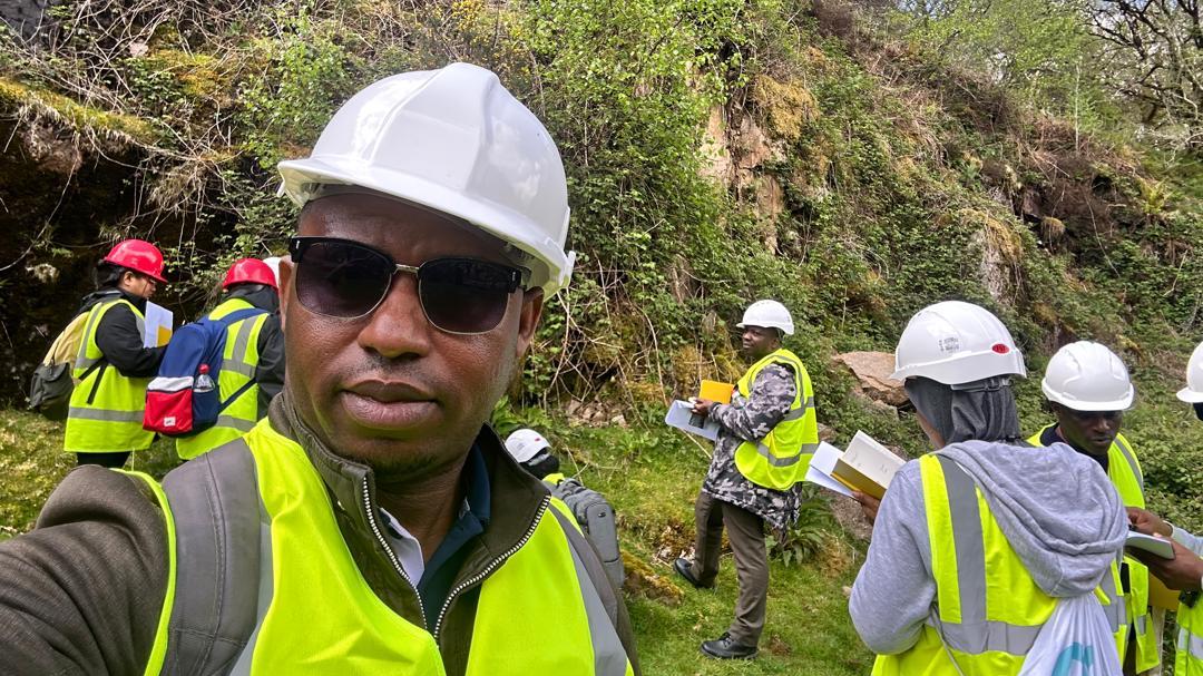
I undertake water quality assessment and pollution research. Being a native of the Niger Delta, Nigeria – a region that has suffered over six decades of hydrocarbon pollution with deleterious impacts on socioeconomic valuables including water, – I have personal and professional experience of water pollution and its impacts on the local population. My research addresses assessment, monitoring, and management of water quality across both developing and developed countries. I have had the opportunity to engage with policymakers on water governance and sustainable policy towards ensuring safer access to water.
What first connected your work in environmental science with space technologies and water-related issues?
I have personal experience with drinking rainwater. From childhood, rainwater was a cherished source of water for domestic use, including drinking and cooking. At certain times, the rainwater would become dark in colour, yet as there were no alternatives, we continued to use it for domestic purposes. I grew up to understand that acid rain was poisonous and could impact public health. I became passionate about solving the problem of air pollution caused by indiscriminate and unsafe hydrocarbon refining, which contributes to acid rain in my region. This triggered my passion to address an important question of water contamination in Nigeria.
You have extensive experience with oil-contaminated sites. Where do you see the strongest role for Earth observation in monitoring water quality or detecting pollution events?
The strongest role for Earth observation (EO) in monitoring water quality would be in the use of remote sensing to evaluate the proximity of oil infrastructure to water sources such as boreholes, rivers, and streams. This could also be used to monitor and detect pollution events.
What are the biggest gaps in today’s water monitoring systems that EO technologies could help close?
EO technologies could help with sparse and non-functional in-situ water monitoring networks. Many hydrological gauging stations in Nigeria are non-functional or inconsistently maintained. This leads to limited long-term records of river levels, sediment loads, and water quality. Existing monitoring is often point-based, which is unable to capture the spatial complexity of creeks, estuaries, floodplains, and tidal channels that characterise the area. Field monitoring is a challenge in remote or insecure areas affected by oil infrastructure and access constraints. To address this, satellite altimetry, multispectral imagery, and SAR (Synthetic Aperture Radar), e.g., Sentinel-1, can be used to estimate surface water extent, water levels, and inundation frequency. This could provide regular coverage regardless of terrain.
Can you describe a project you worked on that you consider particularly impactful and explain why?
Most of my water-related projects have been on policy, governance, advocacy, and research aimed at identifying the impacts of contaminated water on public health. Although I am yet to participate in EO projects, my research so far has been very impactful. For example, my advocacy on water quality in Ogoniland contributed to the development of emergency water supplies in the region, which facilitated the development of regional water schemes in selected communities. As a result, several heavily oil-contaminated communities in Ogoniland now have access to potable and safe drinking water following years of advocacy. I am currently seeking funding for a 5-year water quality monitoring regime in the region to investigate access, quality, affordability, and quantity, and how these impact local livelihoods and public health.
You often work at the interface of science, policy, and communities. How can space-derived information support water governance?
Space-derived information supports water governance by turning complex, contested water systems into shared, transparent evidence, enabling scientists, policymakers, and communities to work from the same factual baseline. By providing consistent monitoring of floods, pollution, ecosystem change, and water availability, EO helps policymakers design adaptive regulations while giving communities timely, actionable insights about risks to livelihoods and health. Its independence from local political or institutional constraints strengthens accountability and trust, especially in regions where in situ data are sparse, disputed, or inaccessible. At the science-policy-community interface where I work, EO data thus acts as a boundary object, translating scientific knowledge into decision-relevant information that empowers inclusive and evidence-based water governance.
Which emerging EO tools, platforms, or missions do you believe hold the most potential for improving water management and environmental remediation?
The list is inexhaustive. Although this is not my area, what I have read indicates that the NASA-CNES SWOT (Surface Water and Ocean Topography) mission could provide near-global, high-resolution measurements of river width, surface water elevation, slope, and storage, including streams and estuaries. Also, Sentinel-1 SAR provides all-weather, day-and-night imaging, which makes it very useful in cloud-covered and humid regions where optical data often fails. This could support mapping of oil spills, surface water extent, and wetland inundation. I would also point to the growing role of AI-enabled EO and digital twins, which could enhance predictive, decision-ready intelligence and not just maps.
If you could shape one policy reform to accelerate the use of space data for water security in developing regions, what would it be?
If I could shape one policy reform, it would be to mandate that publicly funded water, environment, and infrastructure programmes in developing regions, such as the Niger Delta of Nigeria, must systematically integrate open-access EO data alongside in-situ monitoring. This will address a major challenge by integrating legal requirements with capacity building and co-production/co-management, ensuring scientists, policymakers, and communities can jointly interpret satellite data for decisions on rivers, pollution, and ecosystem restoration. This will ensure space-derived data are seen as essential public infrastructure for water security.
What are the three skills you use daily in your research?
I use environmental systems analysis. I apply systems thinking to understand how water, soil, ecosystems, pollution, and climate processes interact, particularly within coastal environments. I also adopt geospatial and data-driven evidence to analyse, integrate, and interpret spatial and environmental datasets, e.g., water quality indices, monitoring datasets, to identify risks, patterns, and trends. Lastly, I adopt knowledge translation and stakeholder engagement by translating scientific insights into policy- and community-relevant contexts, thereby bridging technical evidence with governance, planning, and local decision-making.
What is your favorite aggregate state of water and why?
This would be liquid, because my research mostly focuses on rivers, groundwater, wetlands, and polluted surface water, where water serves as a pathway for transport of contaminants, sustains ecosystems, and directly affects livelihoods. Liquid form is also the state where water can be remediated and monitored, which makes decision-making possible in real time.