Interview with Gregory Giuliani, Head of the Digital Earth Unit (GRID-Geneva) & Senior Lecturer in Earth Observations (UNIGE)

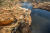
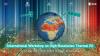
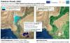
In this interview, we discuss how time-series of satellite data can be used to monitor the environmental, and more specifically the water domain, using the data cube technology.