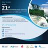
Interview with Terefe Hanchiso Sodango, Assistant Professor at Wolkite University
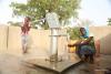
Water scarcity and quality decline is a rapidly increasing challenges and becoming a top concern globally. To wisely manage water and achieve sustainable development, rapid and precise monitoring of water resources is crucial. Earth observation (EO) technologies play a key role in monitoring surface and underground water resources by providing rapid, continuous, high-quality, and low-cost EO data, products, and services.
Currently, there are promising efforts in the use of EO technologies for water resource management but there are still huge gaps in the Africa region. The reason for the low utilization of EO technologies can be due to a lack of resources and funding including skilled and motivated human resources in the field and the lack of political commitment to foster EO products, data, and services. Therefore, the use of space technologies and their products to solve water-related problems needs collaborative efforts of all concerned stakeholders from global to local levels.