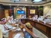
Interview with Prof. Hesham El-Askary

Prof. Hesham El-Askary works at Chapman University in the Earth Systems Science Data Solutions (ESsDs) lab. Here, he supervises students on the use of satellite earth observations for topics including agriculture, water resources, air quality and climate action, and makes use of Artificial Intelligence (AI) and Machine Learning (ML). Prof. El-Askary is researching natural and anthropogenic pollution’s influence on the environment and is particularly interested in the concept of “glocal” impact—how what’s happening globally in terms of climate affects us locally. He believes that one of the biggest challenges in implementing sustainable water management is the lack of data to monitor progress, and advocates for space technologies to mitigates this shortage.


.")
")