Canada

Alpha 3
CAN

Related Content

Article

Event

Local Perspectives Case Studies

Need for water quality data to monitor effects of mining and industrial use of water near Lake Athabasca, Canada

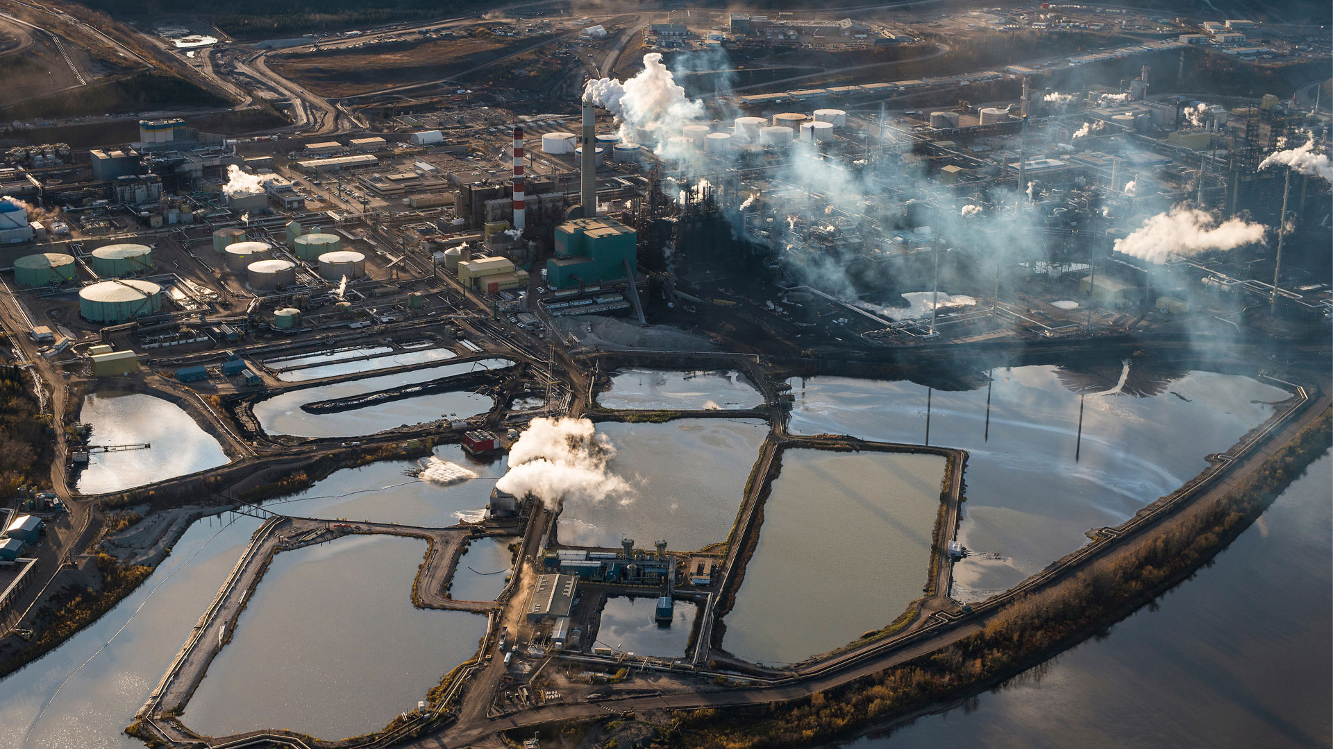
Tar Sands - Photo by Garth Lenz
The community is nestled on the northwest shore of Lake Athabasca and downstream of tar sands/mining extraction and hydroelectric dams. The challenge the community faces is the lack of data on the industry water use and how that is or will affect the community in the future. There is a need for data that will help with informed decision making for active stewardship and monitoring. We have estimated that it will cost about 17 billion dollars in liability if reclamation and remediation is not done to bring back the boreal ecosystem. Therefore, we need data to aid in decision-making and adaptive management to determine whether the current management practices and solutions are effectively working. This could be data on biodiversity, for example of benthic vertebrates to access the health of the water ecosystems and also water quality. Currently we do not have such data. Right now, they are doing progressive reclamation where they are revegetating as they are mining but we cannot evaluate whether this is successful or not. We do not know if the species they are using for revegetation are improving environmental quality or not. We need to develop criteria to determine the success of reclamation by evaluating if specified targets are met with a particular time period and if these are not met then identify what could be done differently – adaptative management.

Map

Click on any of the highlighted countries to retrieve further information.

Stakeholder

b.geos GmbH

b.geos offers Earth Observation services using state-of-the-art remote sensing technologies. We develop value-added products, conduct basic research, provide consultancy in remote sensing technologies and applications, as well as training.

H2O Geomatics Inc.

H2O Geomatics is a research spin-off from the University of Waterloo. The company uses state-of-the-art remote sensing technologies to turn Earth Observation (EO) data into products and information tailored to meet end-user needs in various domains of application. H2O Geomatics is also conducting R & D activities on machine learning algorithms to handle big EO datasets as well as the development of environmental risk assessment tools for climate-dependent sectors such as agriculture and water resources management.

Services offered by the company include:

Person

Software/Tool/(Web-)App

ISME-HYDRO

ISME-HYDRO is a platform that helps monitor water resources of dams, thus enabling water resources managers to better execute their duties. It employs linked data infrastructure integrating in-situ measurements, satellite data, GIS data, domain knowledge, deep learning, and provides capabilities of forecasting of water volumes, of alerting for hazardous situations, of interaction with the data through four kinds of search and GIS interactivity. The platform is easily extendable and customizable.